Kenya from the air

For a long time, I wanted to see the amazing colours and patterns of Africa. This story started when I met the wonderful Gurcharan on board an airplane going back home from Iceland, of course :). It was when the seed of an idea of going and flying in Africa started growing and a few months later I was on board a jet taking me to Kenya.

Flamingos flying over soda brine patterns formed by winds on the Magadi lake surface, cloud reflections on the top of the frame.

Most people think of the amazing wild nature that Kenya has on offer, with the Maasai Mara and Amboseli National parks coming immediately to mind in southern Kenya with the abundance of wild African animals and eons of photo-safari possibilities. But for me the main interest was elsewhere. Kenya lies on the East African rift, with its ancient and young volcanic craters, geothermals and alkaline lakes, outcrops of various geological formations and even outback desert dunes hundreds of miles away from the oceanic coast. So, my disclaimer here is that you will only find a few images of animals (elephants) in this post, and birds, such as flamingos, were photographed primarily as a reference scale and composition booster for the aerial shots.

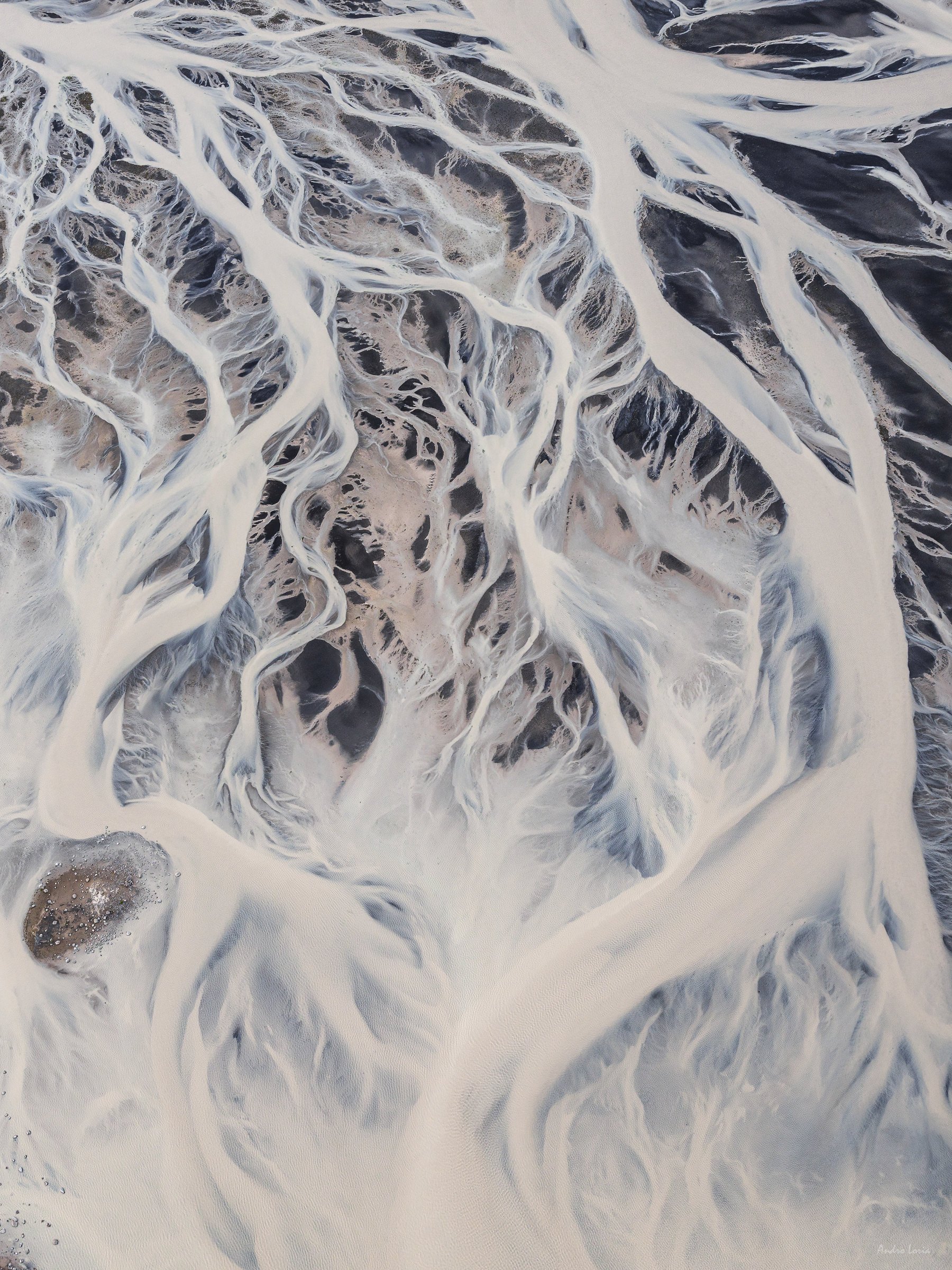
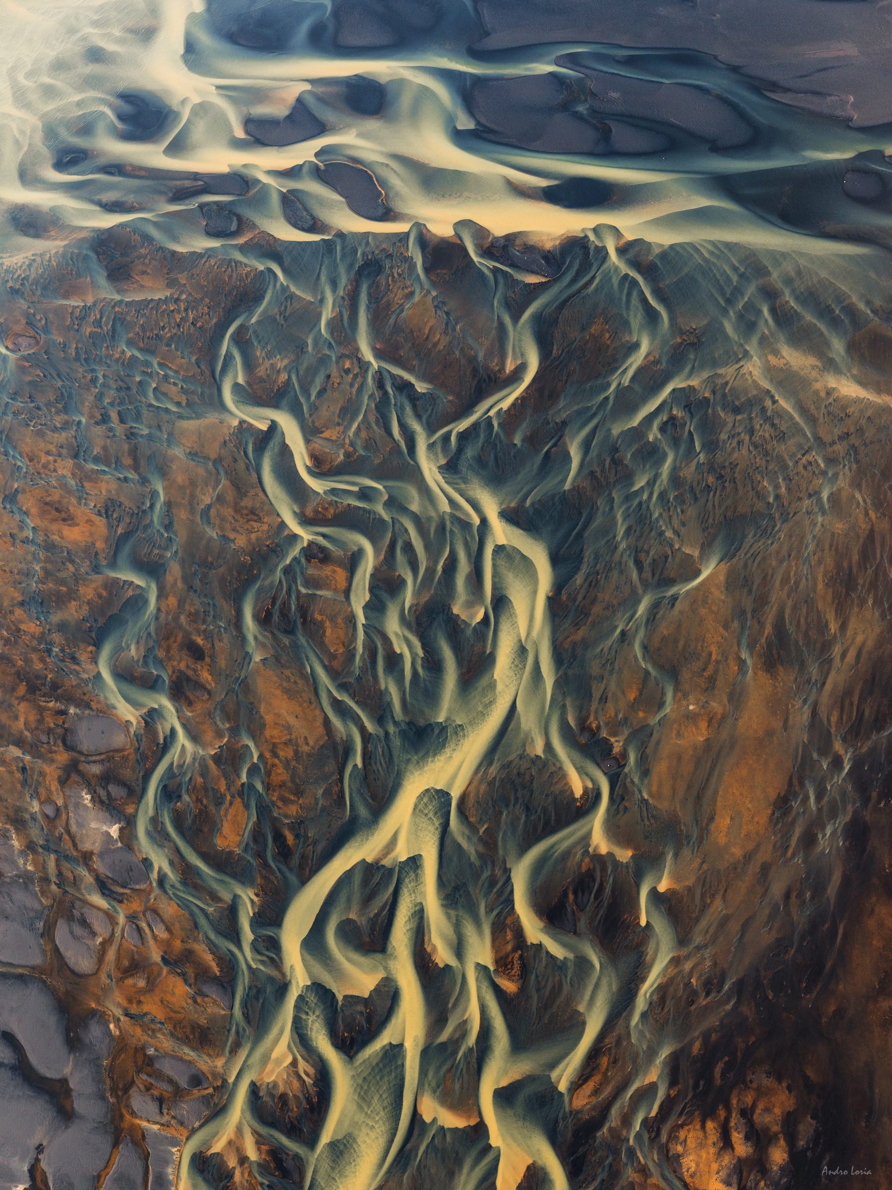
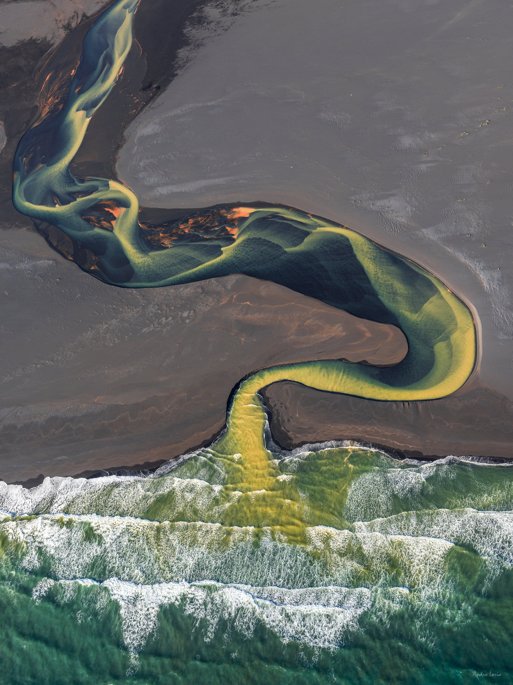
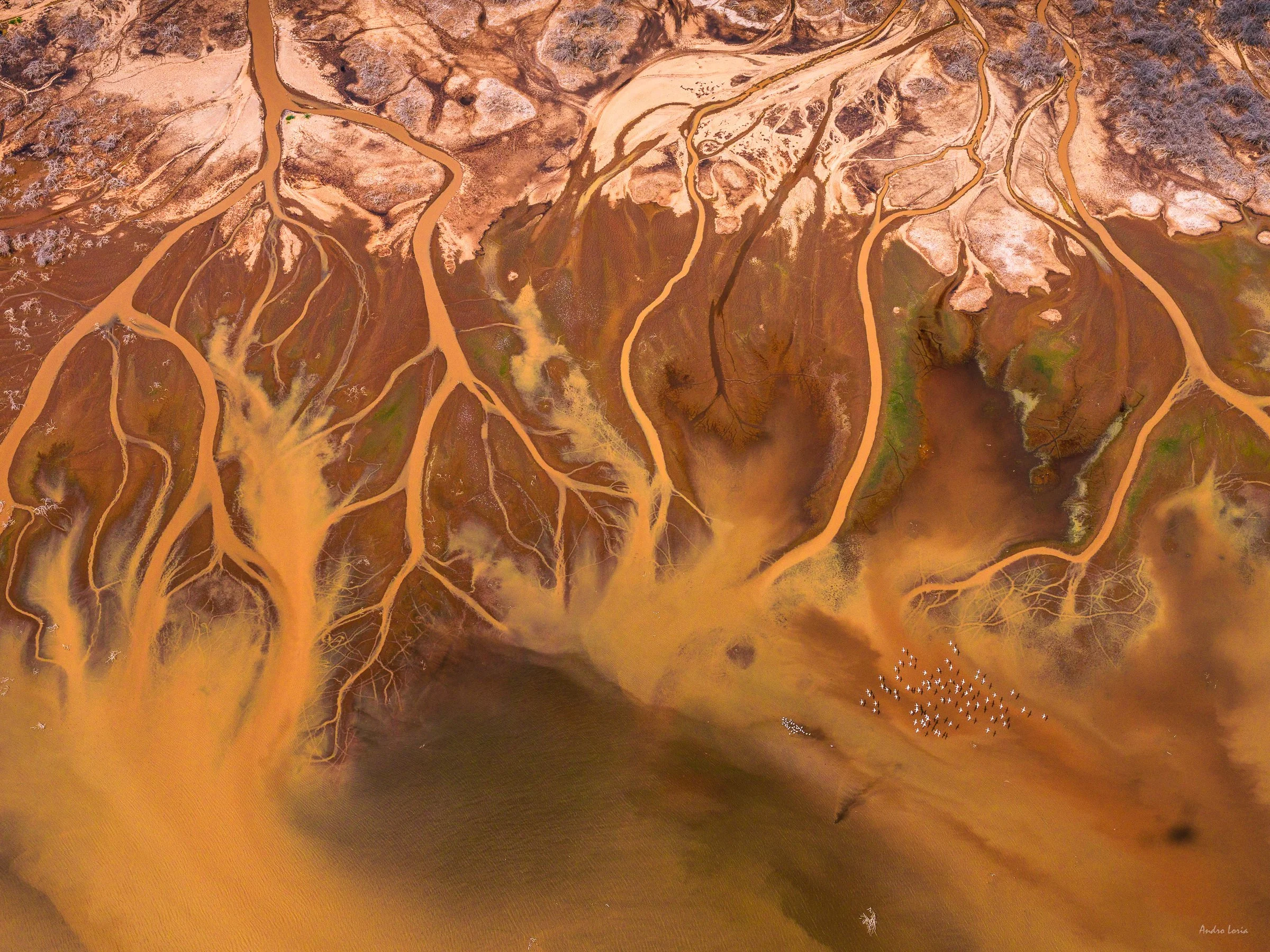
Patterns of coastal streams at the Magadi lake area

Dry soda and soda brine patterns at the Magadi lake area

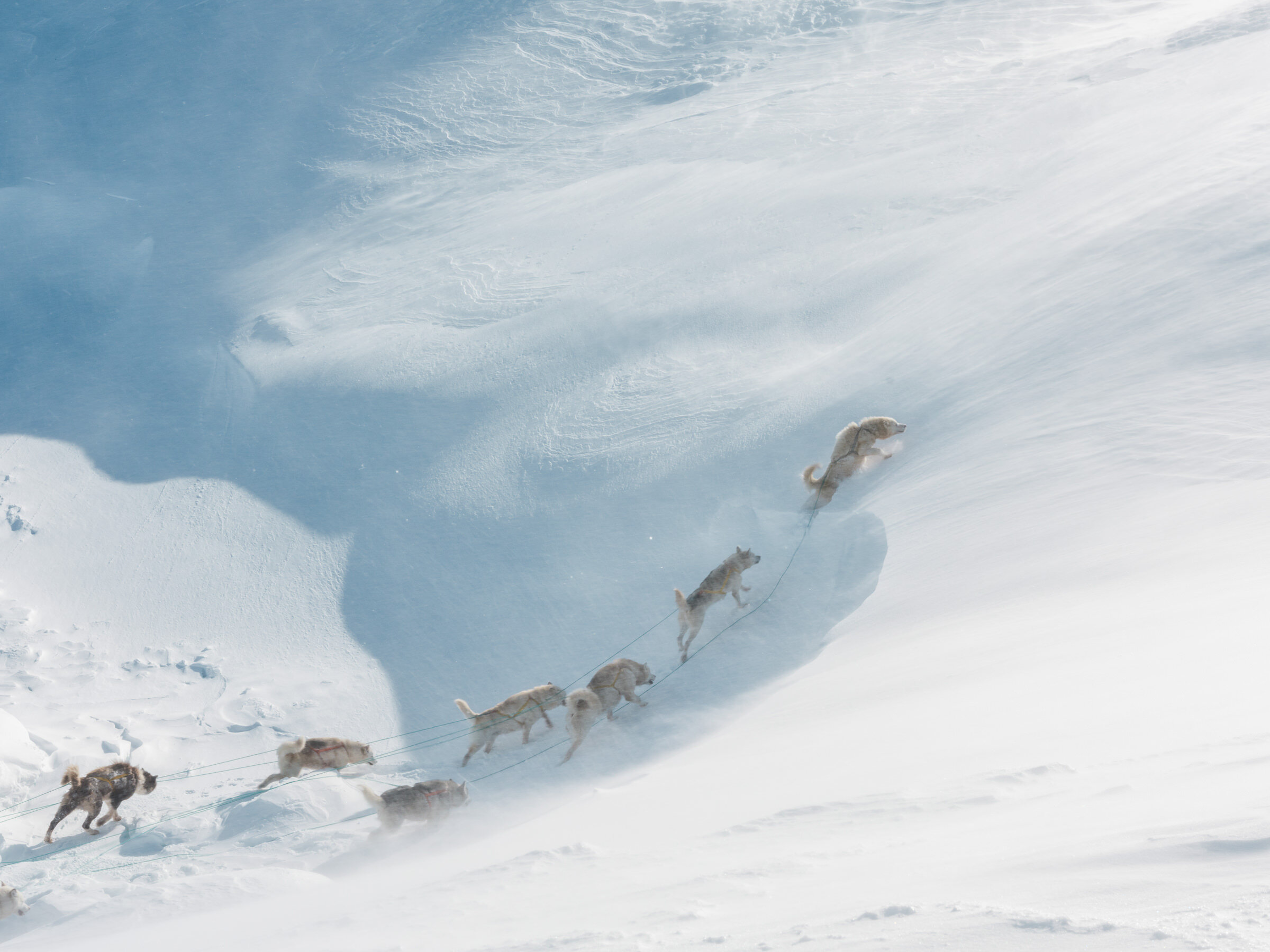
Flying in Kenya. The main difference flying in Kenya compared to Iceland was that we flew small helicopters. The R44 Robinson during trip to South (February) and the R66 when flying in Northern Kenya (November). The ability of flying slow, hovering, making stops pretty much whenever and wherever is needed, 4 to 5 hours range of flying on full tank make these helicopters wonderful machines and very comfortable to photograph from. On both trips the doors were off. Having two photographers on portside (front and back seats) allowed for seamless simultaneous shooting. We flew two separate trips – one to the South and one to the North from our base in Nairobi, around 8 and 10 hours respectively spread over two days for each trip.

Lake Logipi filled with rain water, soda brine patterns and clouds reflection on water. A flock of flamingos left of the centre.

 Algae growth and some dead trees of the coast of Lake Bogoria.

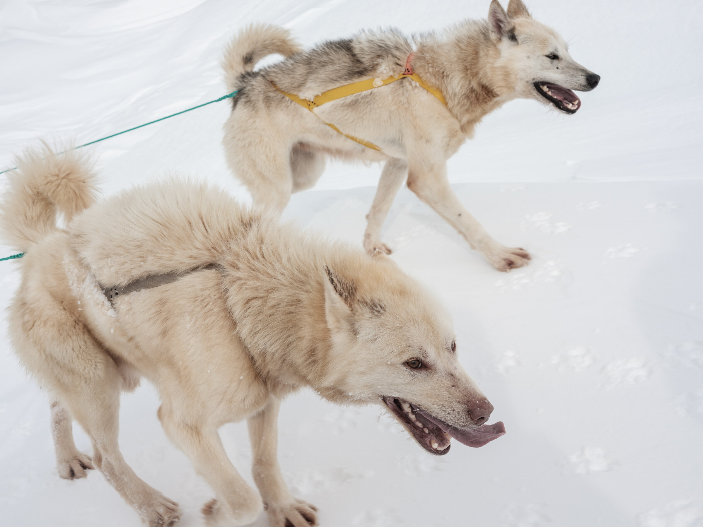
Yes we saw a lot of elephants 🐘🐘🐘 and here is the proof :) Shot from R44 🚁 and R66 🚁 on both trips.

Another big difference of flying in Africa is of course the weather, most of all the heat. Especially when flying over salt flats and lakes during the day. The weather is mostly very stable, which was a pleasant surprise to me for change, but the heat is something one has to be aware of. Temperatures over 40 C whilst flying in doors-off helicopters and being constantly dried by hot air flow require you to stay hydrated, so a large thermal flask of water is a must to have with you.

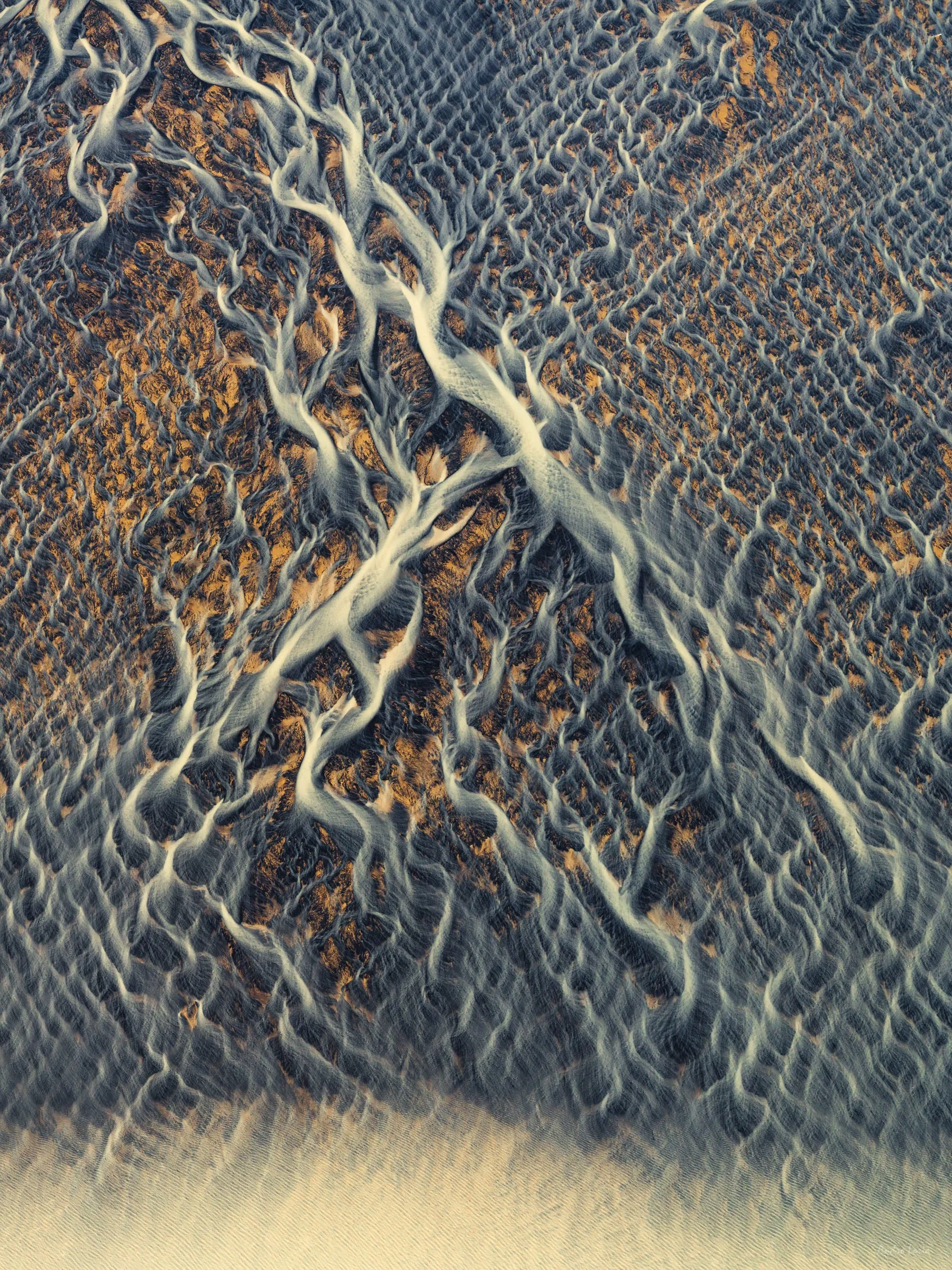
Abstract nature - dry stream beds, Suguta Valley

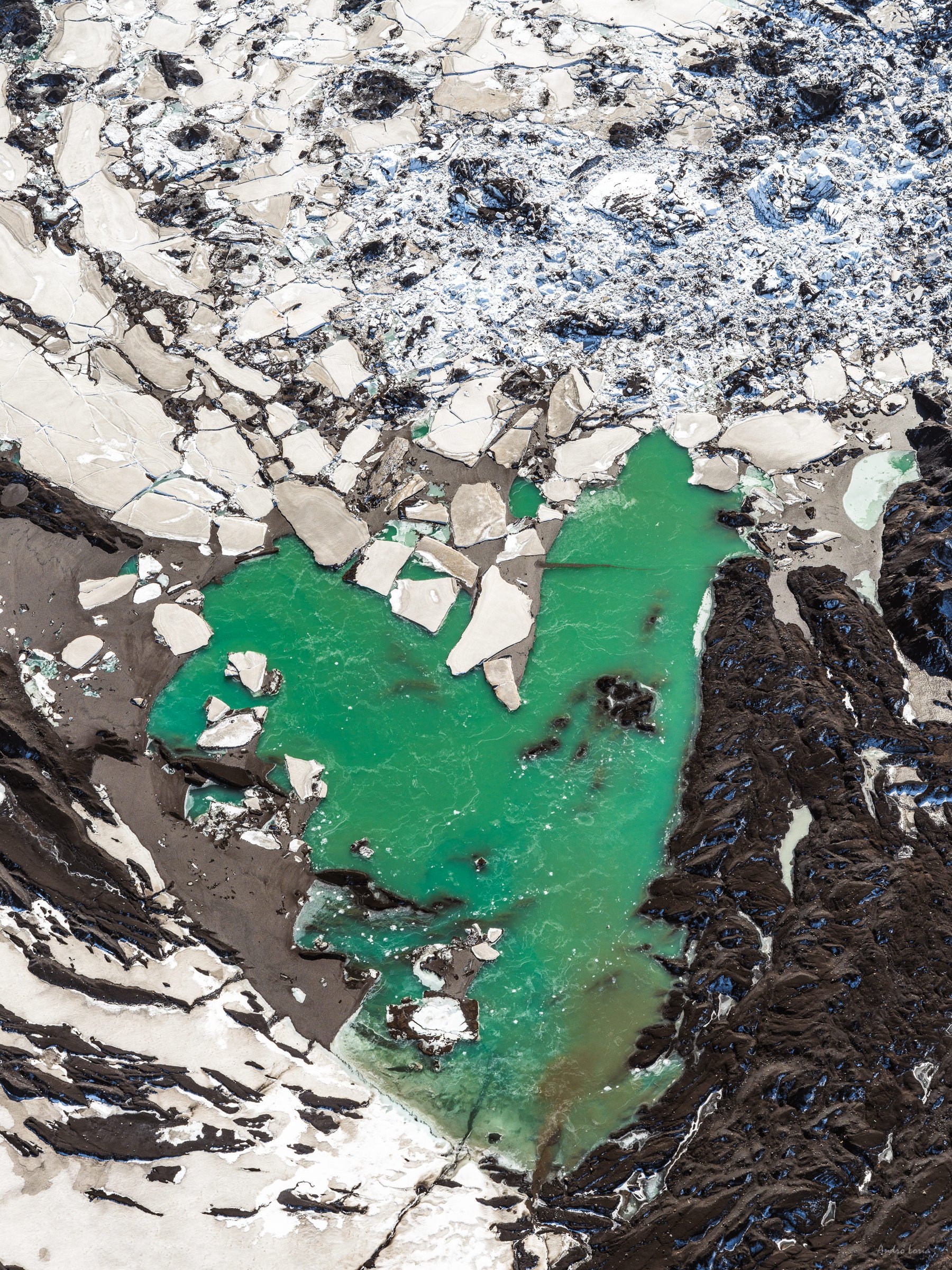
Turkana – Turkana lake is the 4th largest salt lake in the world. The lake is more than 290 kilometres long, 30 metres deep and 32 kilometres at its widest point. Most of the lake is within the borders of Kenya with only a small northern part of it extending into Ethiopia. Lake Turkana is famous for its greenish-blue (jade) colour of water that is created by algae. Its water is not as alkaline as others (pH 8.5–9.2), but has very high levels of fluoride. The lake is home to many species of fish and a large amount of Nile crocodiles. Winds can be very strong at Lake Turkana, as the water mass warms and cools more slowly than the land and sudden, violent storms are frequent.

Nabiyotum volcano crater at the southern tip of Lake Turkana in Northern Kenya, last erupted in 1921, the volcano is ~2.2k ft high, with an inner crater diameter of ~2.5k ft, the outer rim of volcanic conus is ~4.8k ft. 

Dry soda and soda brine patterns at Lake Magadi.

“Crocodile” rock at the Suguta valley at sunset, ~1200 feet long and 100 feet wide. This rock sits in the middle of the plane, open san-blasting winds and sun. A few last sunset rays painted it very nicely.

Take off patterns, flamingos flying near the coast of Lake Bogoria.

Rift Valley Soda Lakes – The East African Rift, on a boundary of the continental rift (African, Nubian and Somali plates), has many lakes, but the smaller ones stretching from Tanzania to Kenya and into Ethiopia on the East of Victoria microplate are a chain of shallow soda lakes such as Natron, Magadi, Bogoria, Logipi, followed by the salt lake of Turkana located in the Eastern (Gregory) Rift Valley.

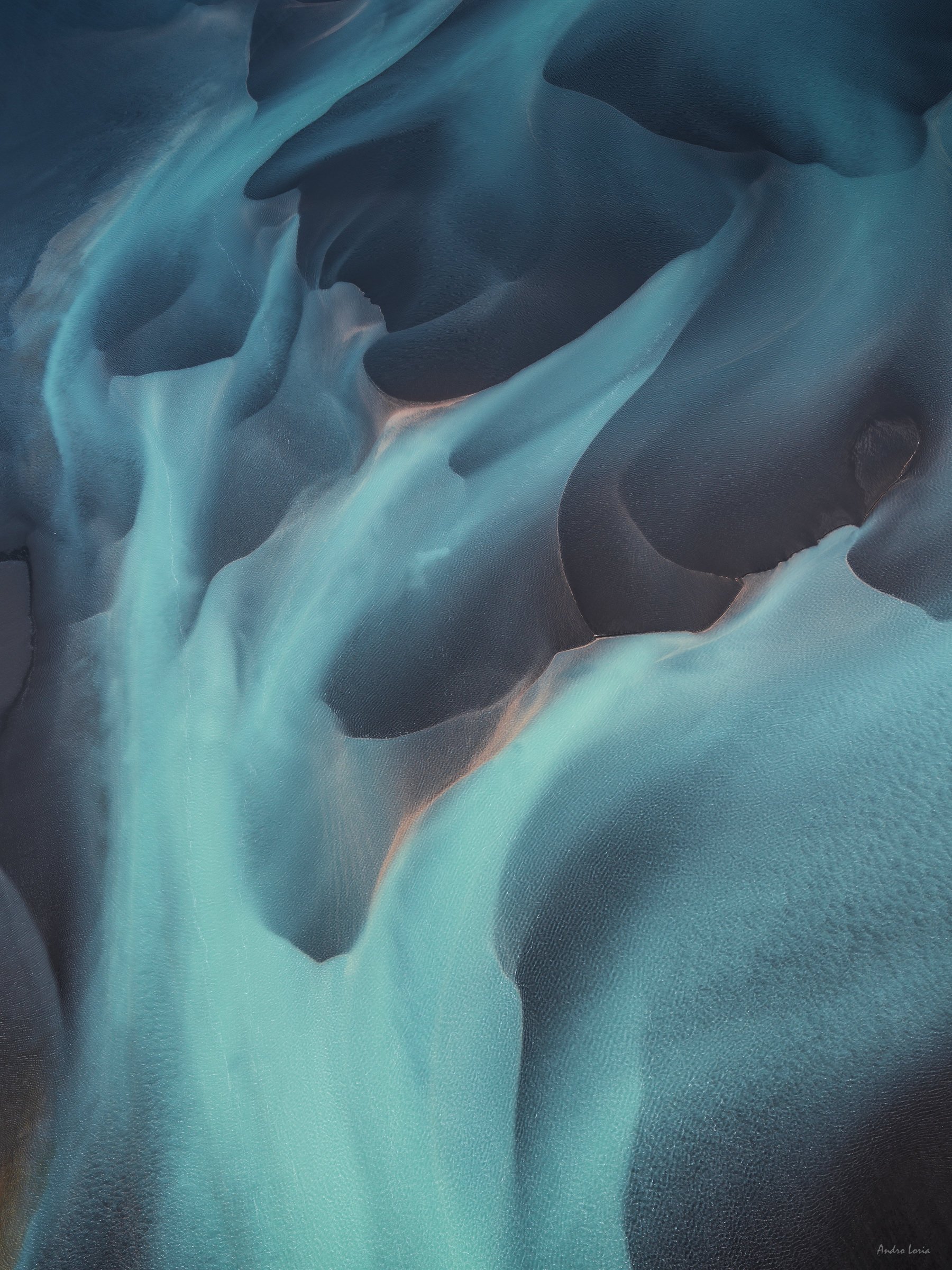
Abstract Africa, Lake Magadi area

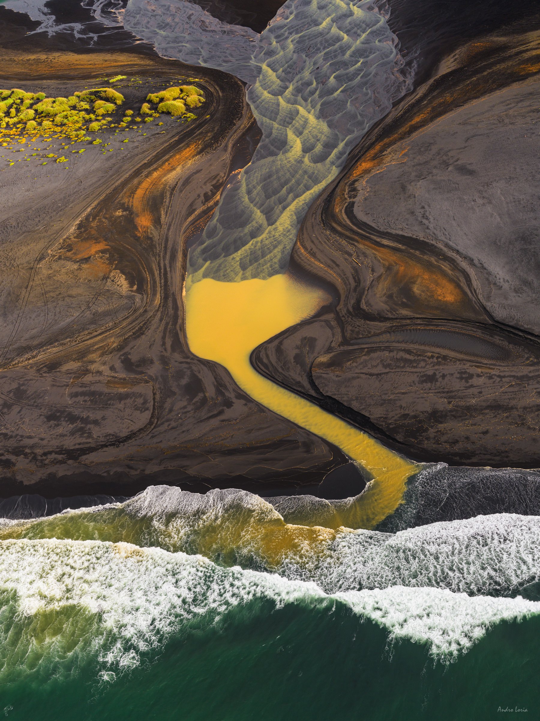
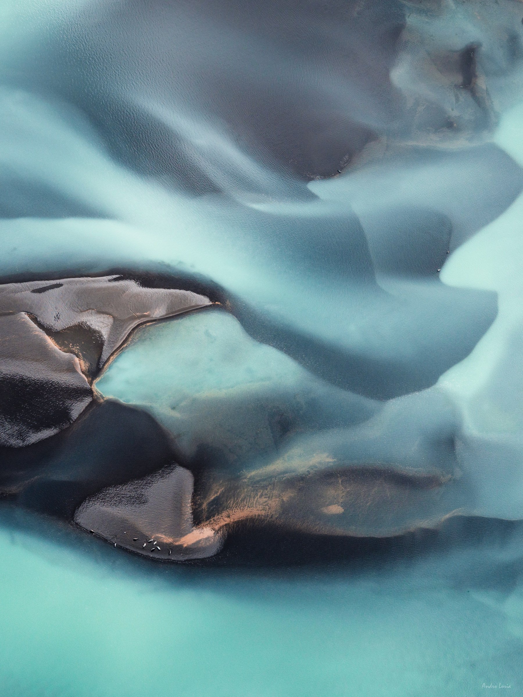
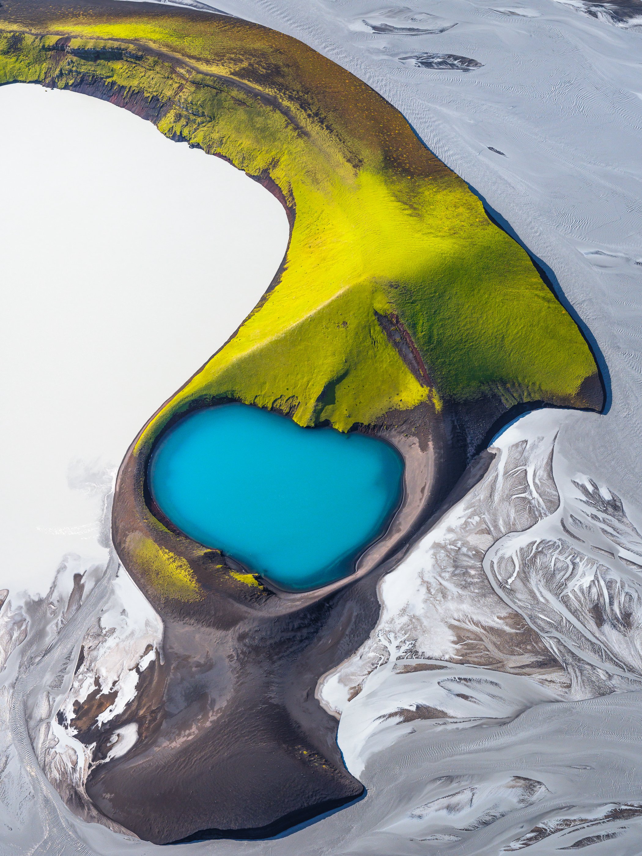
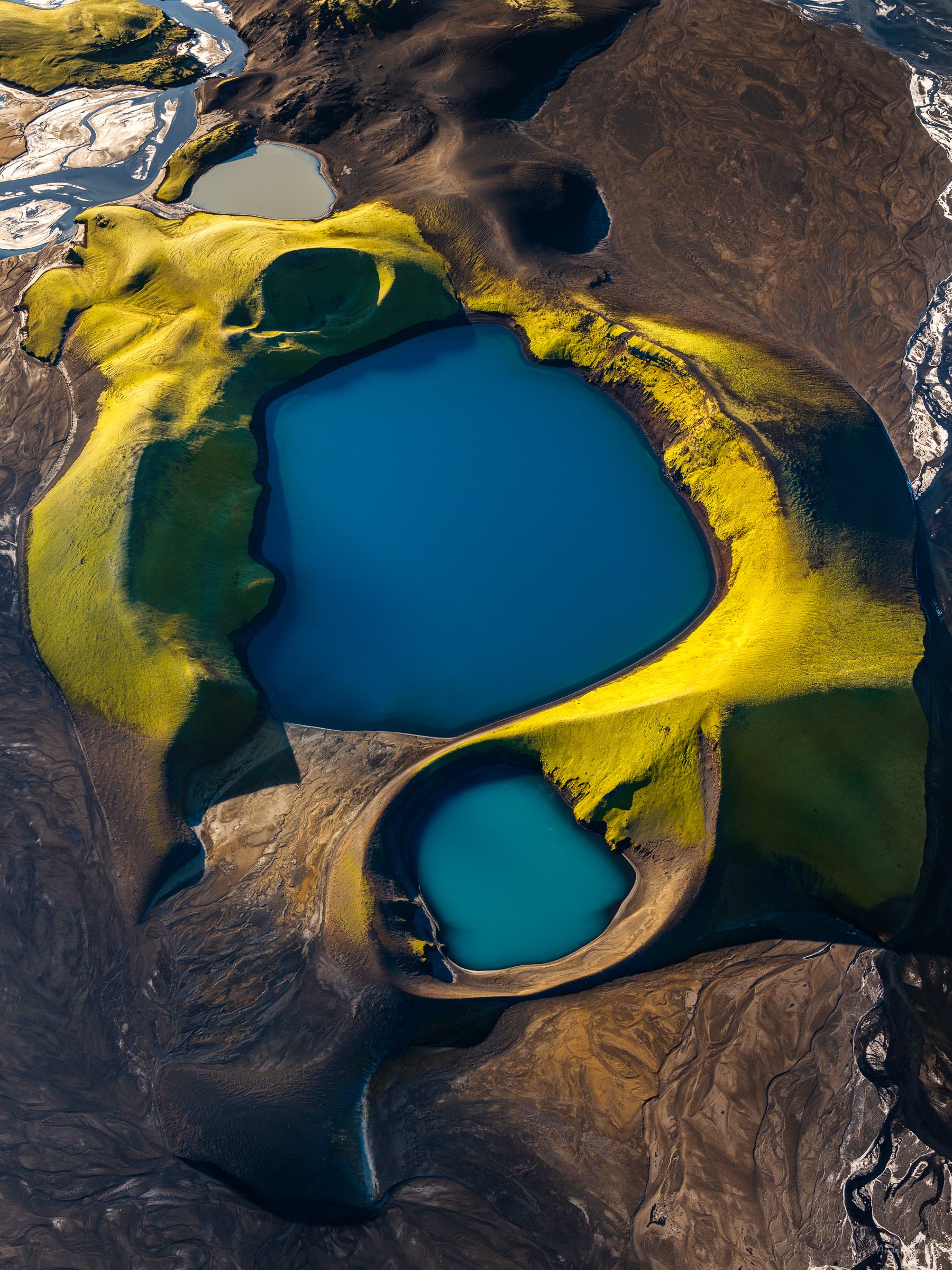
Lake Magadi - a saline, alkaline lake, (pH 10) approximately 100 square km in size, that lies in an drainage basin formed by a graben (depression or trench in crust) at the lowest point in the eastern part of the Gregory Rift Valley. Lake Magadi is one of the most saline, but also is one of the smallest, alkaline lake sumps in the Rift Valley. The lake is about 600 metres above sea level and is a great example of a "saline pan". With no water leaving the lake by streams or rivers evaporation is the only way water levels are reduced, especially during the dry season. This creates a large array of colourful dry soda areas with patterns and colours provided by pigments from algae, plankton, bacteria and tiny crustaceans (like brine shrimp). The cyanobacteria and crustaceans are a particularly preferred food source for flamingos, which acquire their colour from metabolising pigments from their food.

Flamingos flying over the coast of Lake Bogoria.

Flamingos flying over the coast of Lake Magadi. Pink colour from algae bloom.

Patterns of coastal streams, Lake Magadi area.

Old crater filled by sand from nearby dunes, Suguta Valley.

Amazing colours and rocks of the Painted Valley. Suguta Valley

Dunes at sunset, Suguta Valley. Gurcharan is testing his Nikon’s sandproofing, right off centre.

Dry soda and brine patterns, Lake Magadi.

Flamingos flying over soda brine patterns formed by winds on theMagadi lake surface.

Flocks (flamboyances) of flamingos flying through a sandstorm near the coast of Lake Logipi

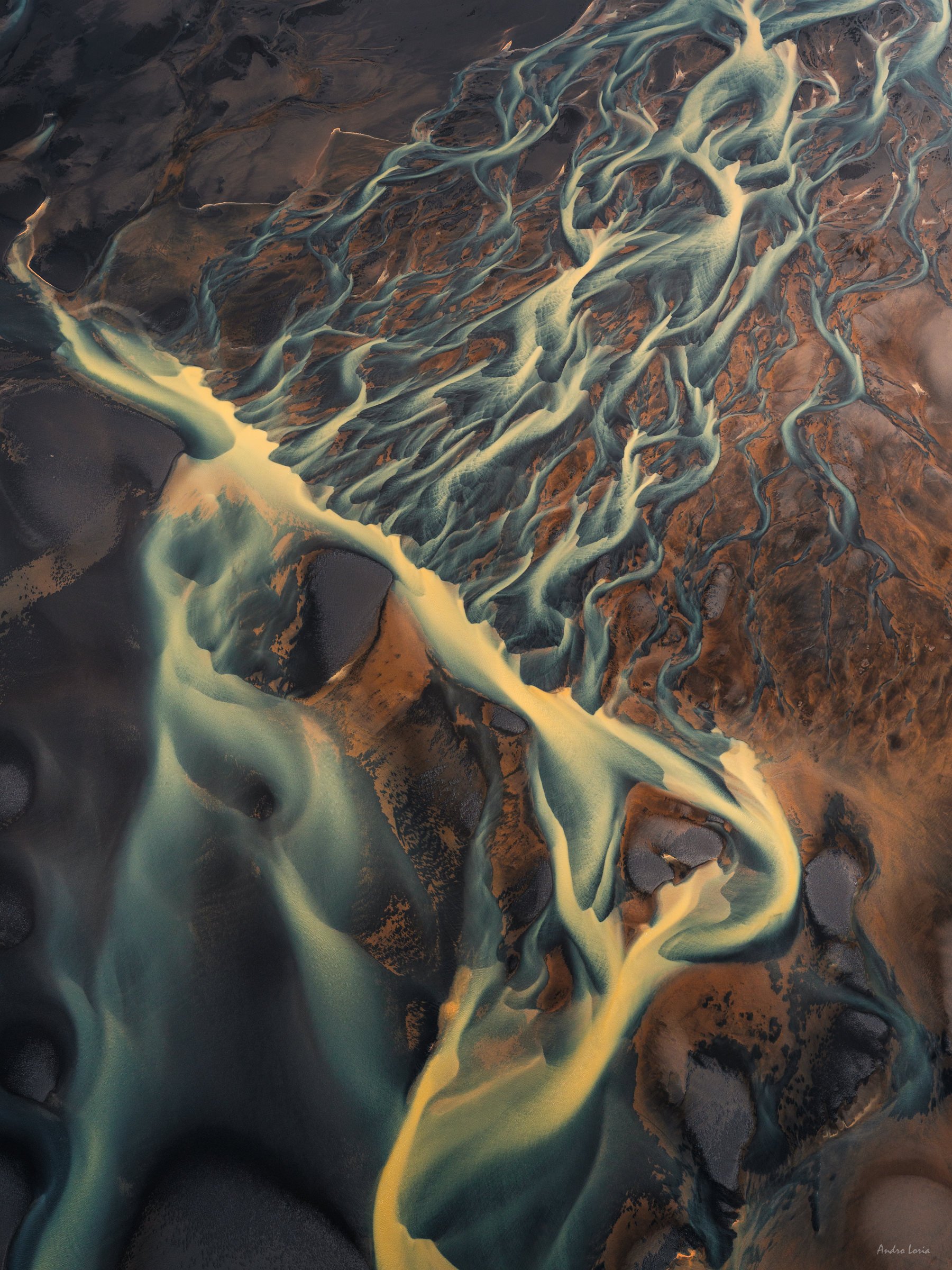
“Fireflies in a magic forest” - dry soda patterns, brine and water of Lake Magadi.

"Sword fish" crater... Colours and texture of one of the many old amazing craters/volcanos at the northern Kenya Rift, Suguta Valley. The crater is ~0.3 miles across (400-450m). The crater is just east of Namarunu –  the large shield volcano flanking along the axis of the East African Rift at the valley’s south west

Natron – a large soda lake (pH 9–10.5). Most of the lake is located in Tanzania, so we did not fly over that part. Yet the northern coastline is rich with patterns of dry soda, with some deep blue shades.

Take off patterns, flamingos flying near the coast of Lake Bogoria.

Bogoria – is the northern most of Kenya’s soda lakes with water pH ~10.5. The lake is extremely salty and has a saline content double that of sea water density. Like the other lakes, volcanic minerals enrich Bogoria’s waters with algae, providing an environment for hundreds of thousands of the lesser flamingos. The shores of the lake are fringed by hot springs and geysers.

A Maasai warrior stands on the red alkaline waters of Lake Magadi. See how shallow this part is with a soda crust under the water.

Flamingos flying over the coast of Lake Logipi.

Lake Logipi  - a minor lake in the northern Rift Valley, it lies at the northern end of the Suguta Valley. Lake Logipi is about six kilometres wide and three kilometres long, it has a maximum depth of five metres and is separated from Lake Turkana by 'The Barrier', a group of young volcanic mountains that last erupted in the 19th and 20th centuries.

Cathedral Rock in the Suguta Valley, northern Kenya Rift. The Rock is made of a young basalt flow (black) and associated tuffs (orange). This volcanic island is surrounded by Lake Logipi, a saline shallow lake with numerous flamingos. 

In the middle of the Logipi lake bed there is a rocky island, Naperito Rock, about 370 metres high, known as the Cathedral Rock, from which hot springs of saline help to maintain the presence of water even in periods of extreme drought.

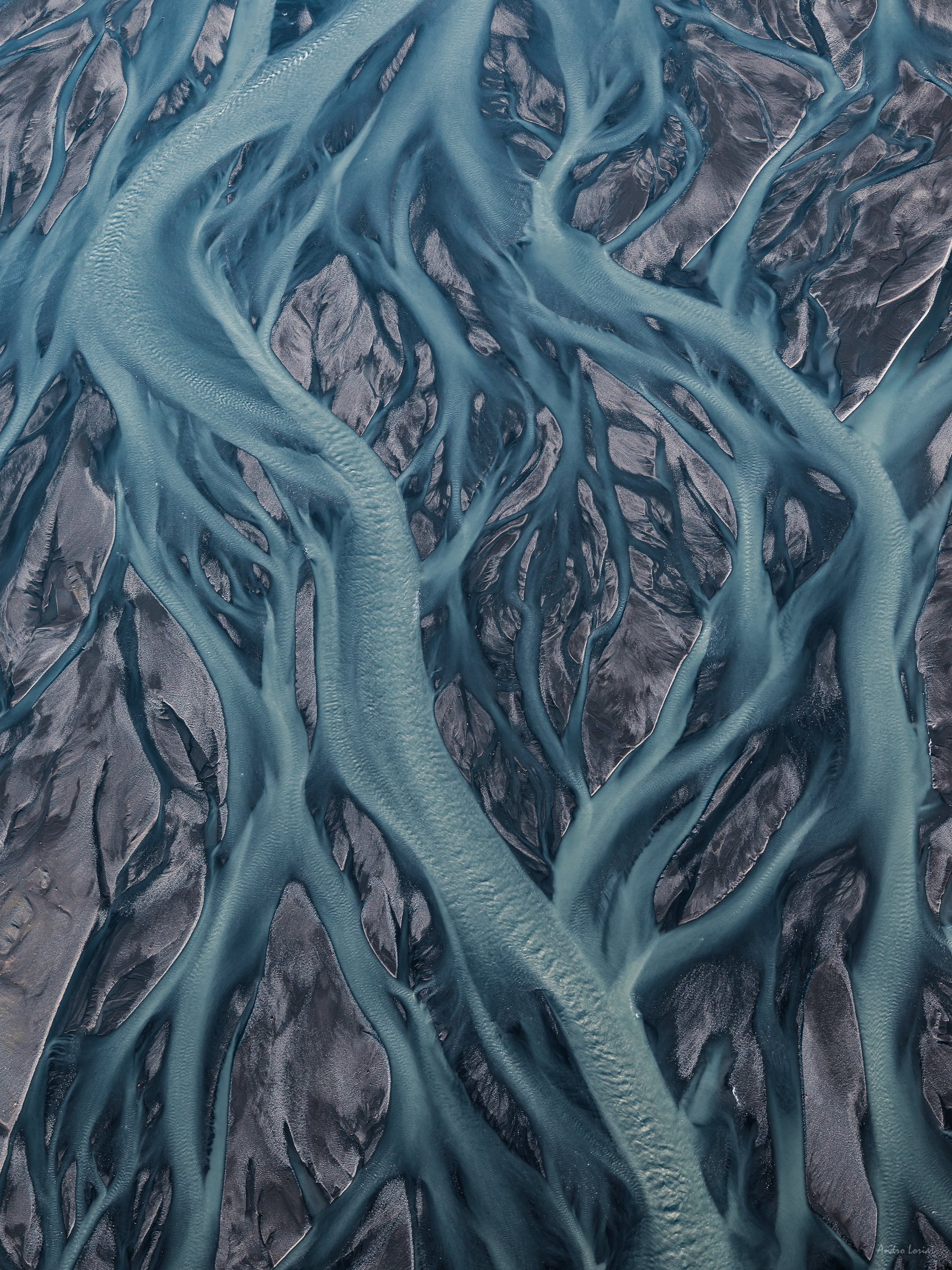
Dry soda patterns and stream, Lake Magadi.

Flamingos flying over the coast of Lake Bogoria.

Flamingos flying over the coast of Lake Logipi.

Dry soda patterns, Lake Magadi.

“Face mask” of one of the Andrew’s volcano craters

Andrew’s volcano is one of the numerous volcanic craters dotting the volcanic ridge, known as The Barrier, that separated the Suguta Valley from Lake Turkana several million years ago. The last eruption took place just over 100 years ago.

Patterns of coastal streams at Lake Magadi.

Old crater, part of Namarunu, the large shield volcano at the Suguta valley’s south west.

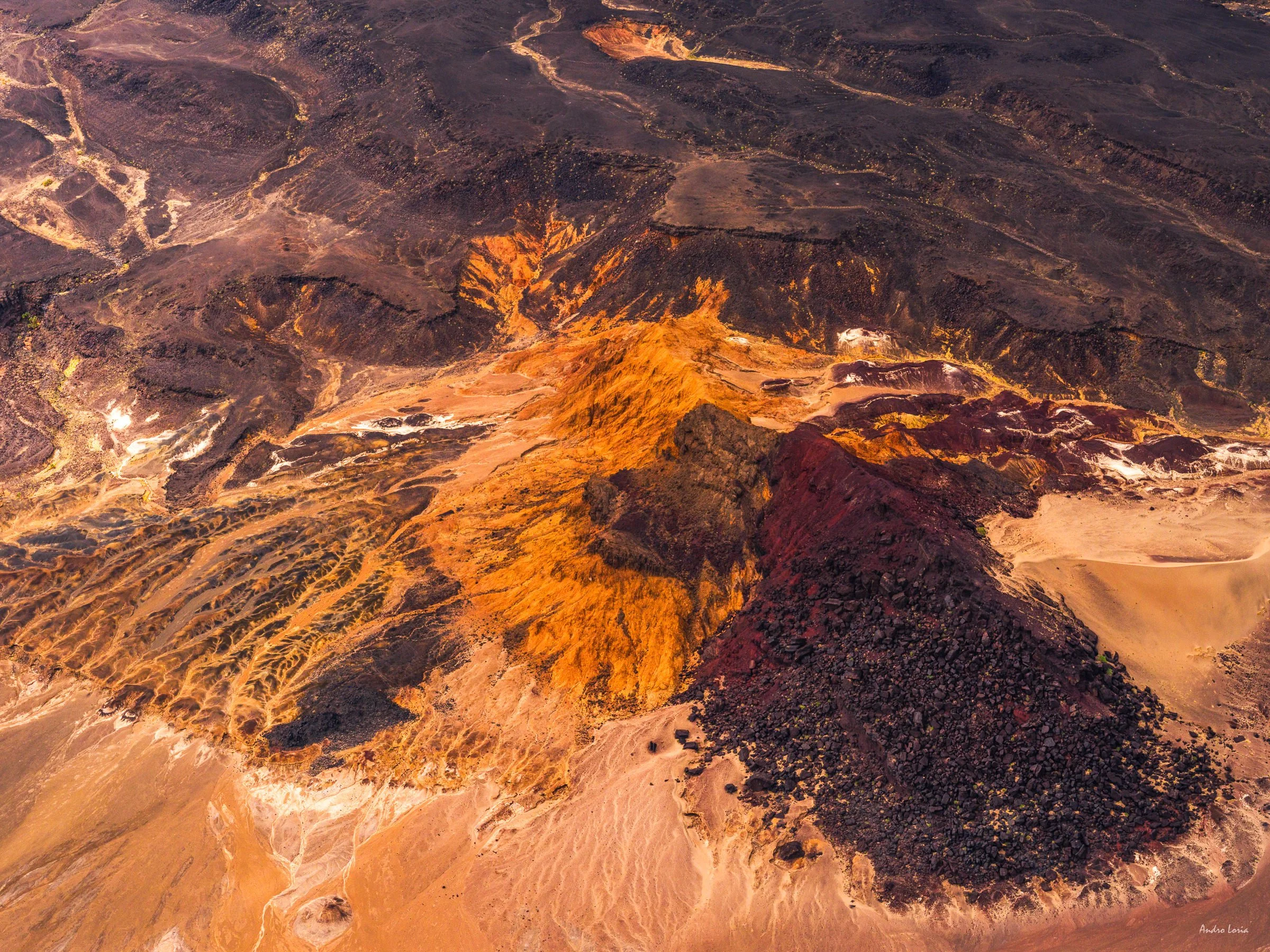
Suguta Valley, one of the hottest places on Earth, nicknamed "The Valley of Death", with huge granite rocks that combine with piles of volcanic ash, gorges of layered rock and miles of sand dunes. Probably one of the most amazing places I have seen so far, it is packed with coloured craters and rock formations. At its northern part there are craters and volcanoes of The Barier and Andrew’s volcano, with Namarunu  the large shield volcano flanking along the axis of the East African Rift at the valley’s south west.

Algae growth and some dead trees of the coast of Lake Bogoria

Dry soda and brine patterns, Lake Magadi.

Flamingos flying over the coast of Lake Logipi.

Old crater, part of Namarunu   the large shield volcano at the Suguta valley’s south west. Basalt black with orange tuffs, reds and yellows of iron and sulphur plus some sand blown from nearby dunes. Purple and lavender tones come from manganese deposits.

Dry soda, brine and streams at the edge of Lake Magadi.

Old crater filled by sand from nearby dunes, Suguta Valley

Flamingos flying over the coast of Lake Logipi.

Sunset at dunes, Suguta Valley

Old crater, part of Namarunu   the large shield volcano at the Suguta valley’s south west.

Flamingos flying over the rain water filled Lake Logipi.

The Suguta valley is drained by a seasonal stream, the Suguta River, which in the rainy season forms the temporary Lake Alablad, a dry lake that combines with Lake Logipi at the northern end of the valley. In the dry season saline hot springs help maintain water levels in Lake Logipi.

Dry soda, brine and streams at the edge of Lake Magadi.

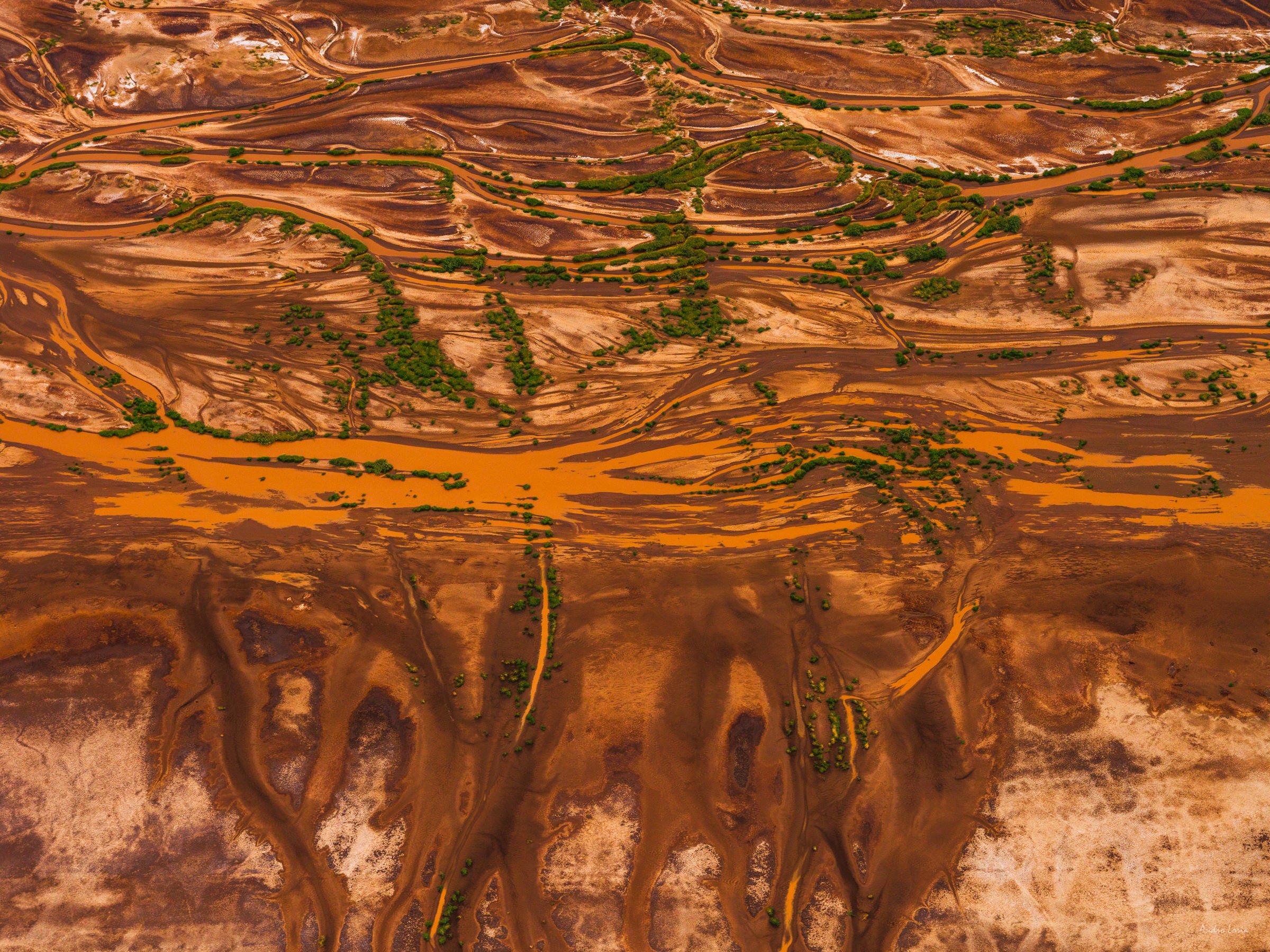
Patterns of rain water streams, Suguta valley.

Dry soda patterns, north shore of Lake Natron.

"Sword fish" crater east of Namarunu   the large shield volcano at the valley’s south west.

Dry soda, brine and streams at the edge of Lake Magadi.

Flamingos flying over the coast of Lake Bogoria.

Flamingos flying over soda brine patterns formed by winds on Lake Magadi’s surface.

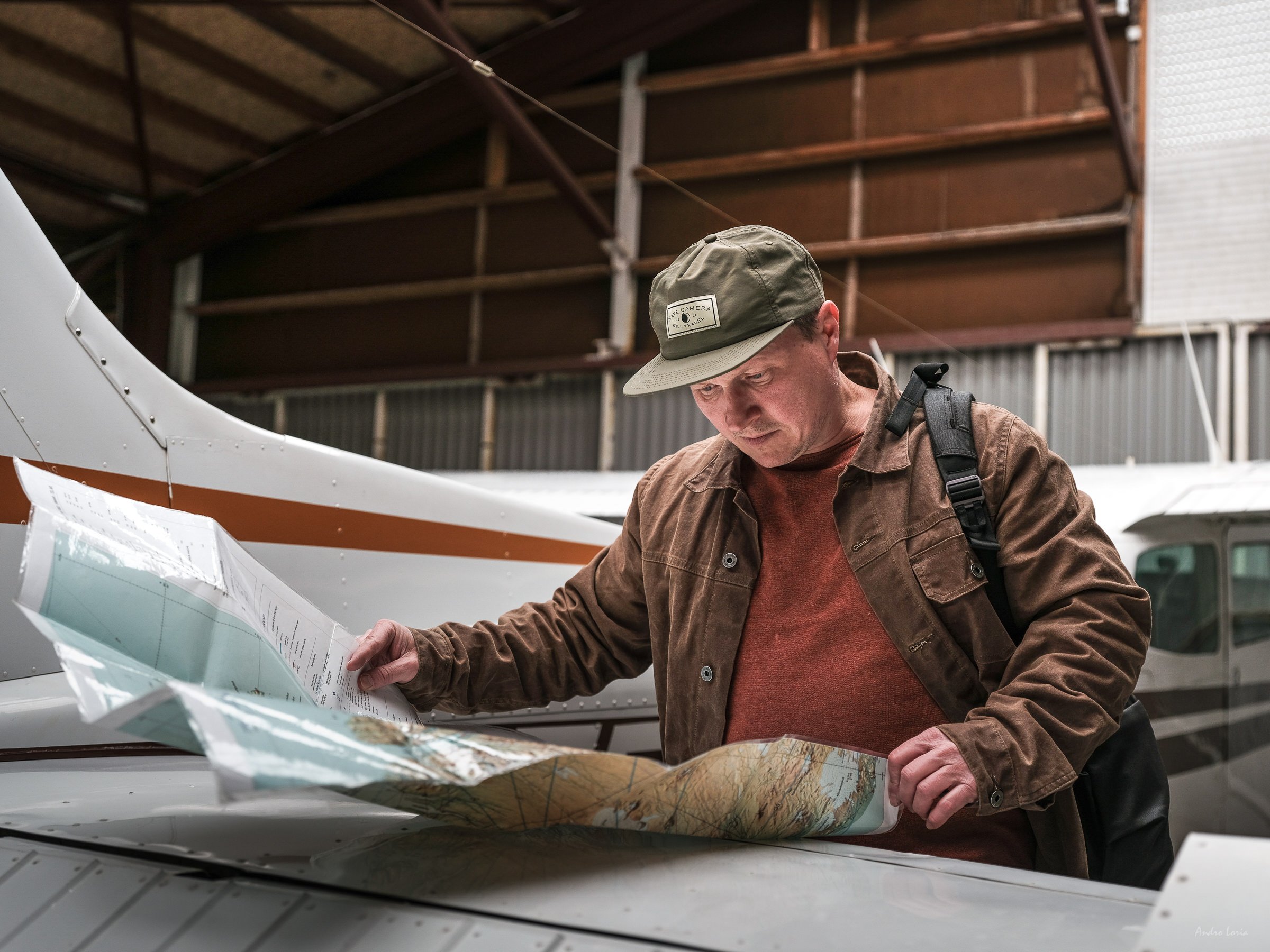
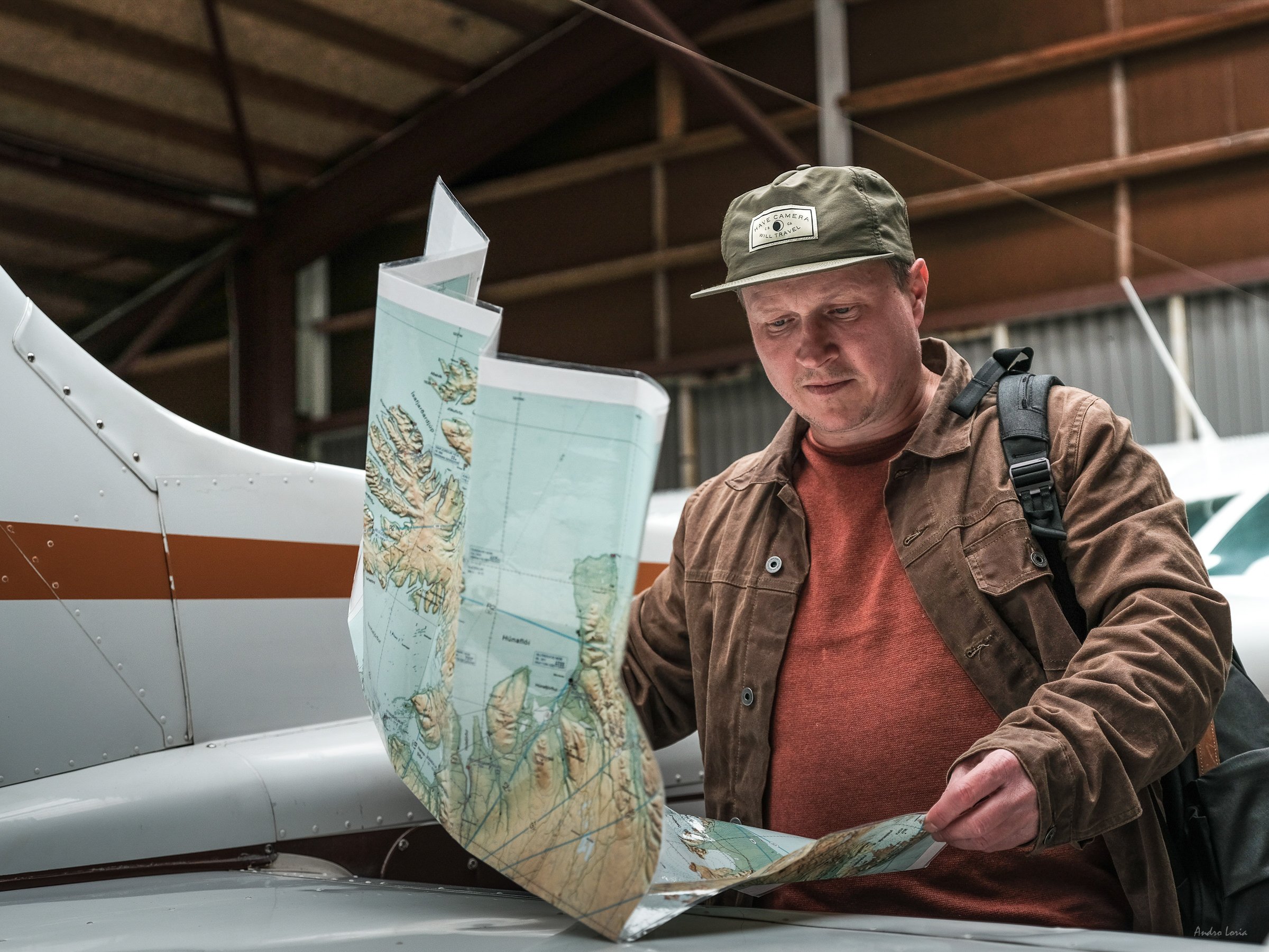
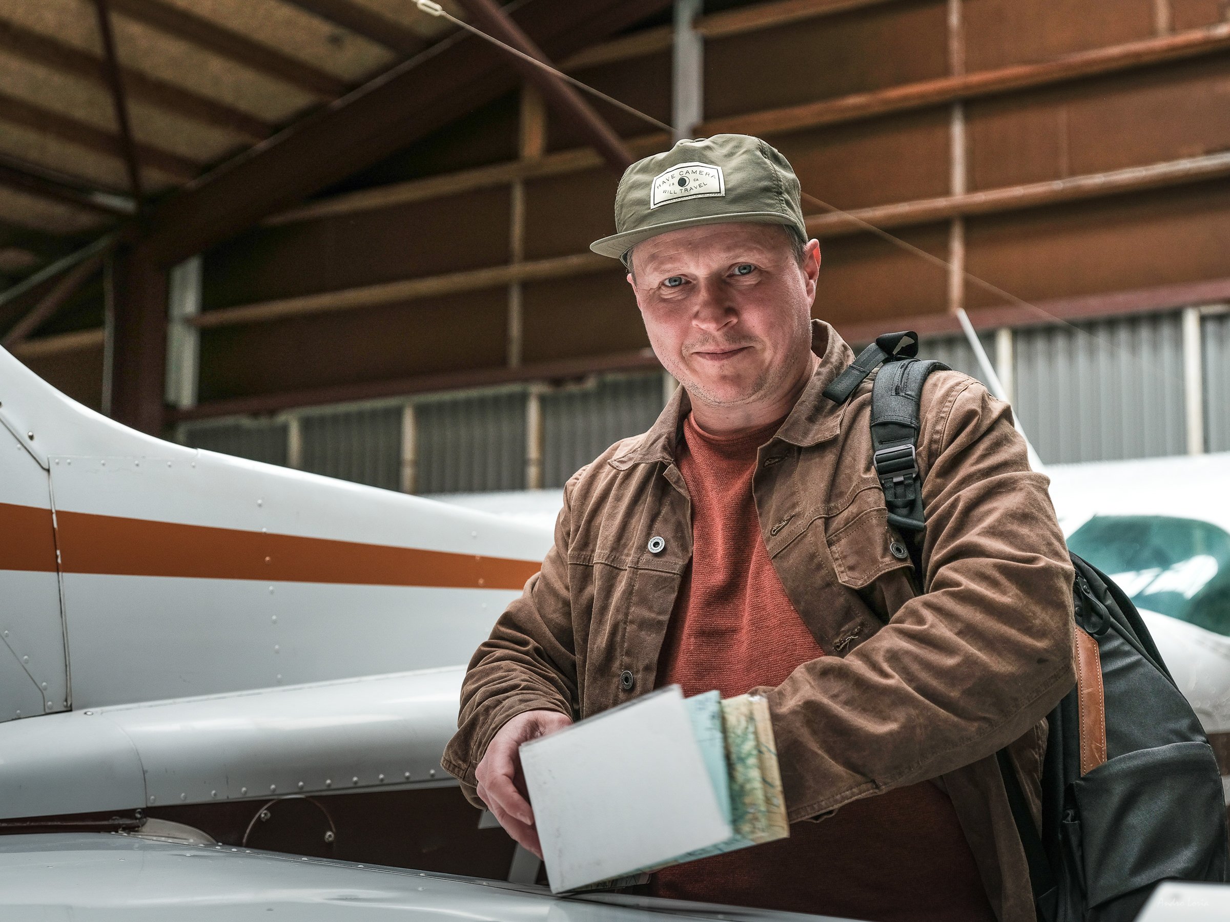
Cameras and lenses – I used two Fujifilm GFX100 bodies, one with 45-100 mm lens and another one with 100-200 mm lens. I use my cameras on manual, playing with the zoom, focus and aperture with a set shutter speed (1/1000) and leaving ISO on auto between 100-400 or 100-800 at lower light. The automatic focus on the GFX100 works great if there is enough texture and contrast of colours below me on the ground and works less well when shooting river/lake patterns due to light reflections. I typically shoot between f5.6 – f14 and 1/1000 shutter speed. For top-down shots, the faster the shutter speed you use the better. The helicopter can slow down, but adds a lot of vibration.

Flamingos flying over the rain filled Lake Logipi.

Before and during the flight – I remove the lens hoods, they take too much air pressure and can knock your lens off in the wind whilst flying. The worst case scenario is that the hoods will get ripped off your lens and fly away. If you are in a helicopter, you really do not want that to happen. I do not use wide lenses - you will have parts of the airplane and/or helicopter in all of your shots. I make sure that spare batteries are easy to reach (and stashed away) in my pocket(s). The same goes for SD cards. Most of my photographs were made from 2,000 to 3,000 feet altitude, although on occasion it was higher, e.g. when the shot was over the top of a large crater or rock formation like Nabiyotum volcano crater.

I would like to say huge thank you to Shompole Wilderness (who also have great hide set-up to photograph wild animals - see their Instagram account) and Desert Rose (a beautiful oasis in mountains decorated throughout with amazingly carved wood) for their amazing hospitality, which we enjoyed in the south and north of Kenya respectively. Massive thanks to our amazing pilots, Marc and Peter, and of course the amazing Gurcharan Roopra for booking a seat next to me on Iceland Air and then guiding and sharing the flights with me over his amazing country.

Aerial photography in Iceland

This post is about flying over Iceland. Over the past five years my focus has mostly been on aerial photography, something I started to think about during my first few visits to Iceland almost 10 years ago when I was taking photographs on the ground. From my experience of mountain trekking I knew that the view from the top is unbeatable, so, I had to try shooting from the air and this was only encouraged by amazing shots by those lucky few (those pre-drone era days) who managed to see and capture fractals of Icelandic braided rivers, abstract patterns and the colours of Africa and South America etc.

Glacier's necklace - glacial pools (kettles) form a giant nordic "necklace" pattern at the edge of piedmont type glacier when seen from above - about 5k ft. Central highlands.

Glacial silk - silt and mineral coloured glacial streams look like silk ribbons when seen from 3000 ft above, creating a natural abstract. South coast of Iceland.

Autumn highlights - late autumn snow and low sun highlight the tops of the mountains and steam from the geothermal vents in the Icelandic highlands.

In 2017 I was lucky to meet a wonderful human and pilot, who was also an excellent photographer, and later become a great friend, the late Haraldur Diego ( @volcanopilot ); flying with him changed my life and photography. Sadly, Haraldur tragically died last winter, so this narrative is partly aimed to put some of those wonderful visual and emotional memories together and hopefully to give some encouragement and advice to those who are  keen to try aerial photography and want to get airborne with their camera, so this will be a long story with  about ninety images taken during different flights over the last four years :)

Convergence - three white birds (gulls, centre) show the enormity of glacial streams’ convergence that gives birth to a river at the western edge of Vatnajökull, as seen from above (>1200ft). The streams are coloured by different minerals and silt. Vatnajökull, Iceland,

Oasis - moss on the mountain slopes contrasts the blue of the crater lake and the silt-rich grey of Skaftá river during a glacial run in the Southern highlands

Glacial forest - glacial streams coloured by silt run from Vatnajökull forming a tree-like natural abstract when seeing from above from about 3000ft.

Highlands - glacial rivers and lakes, black volcanic sand, luminescent moss on moisture-rich areas and mountain slopes, ever changing weather - all combine to create Icelandic natural art.

The uniqueness of the views, the ever-changing patterns of landscape and light and fast changing scenery all make aerial photography very challenging, but also very rewarding. The views from above in Iceland are like views from a different planet and often have an other-worldly feel about them. Sometimes they look like a vascular system, nature repeats its patterns, and sometimes like a giant neuronal network laid out on the ground. Seeing and photographing from the air is both a challenge and an immense pleasure and privilege.

Seals on the sand banks of the Ölfusá river, South coast of Iceland.

Yggdrasil - or what looks like the top section of a mythical tree is a combination of glacial river streams that carry silt and minerals from the nearby glacier, Langjökull, to a small lake and in doing so, create some of the best abstract natural art in the world.

Flames - silt-coloured streams of a glacial river as seen from a couple of thousand feet above.

Birds over Ölfusá river, South coast of Iceland.

Heart on fire - glacial river streams carry silt and minerals over colourfull volcanic sand and create an amazing scenery that looks like the flames of a fire forming a heart shaped pattern when seeing from above. Or maybe it is a first sighting of Groot in Iceland? ;)

A few gulls - white specks over converging streams of glacial flow coloured by silt and minerals at the edge of the Vatnajökull glacier. From above (~3000ft) it looks like a natural abstract.

At first, on your first couple of flights, everything happens very fast, perhaps too fast. You have no time to see everything coming at you and you barely have time to frame, compose and change the settings on your camera and lens. With time, playing with light and composing from a fast moving aeroplane becomes great fun and even when you take a few fly-overs, typically in circles, over a specific area that caught your eye and mind, it never really looks the same, as the light and shadows from the clouds and mountains move. You can gain or drop some altitude and so the angle of view and the shot(s) changes too and with them your feelings and ideas about how to frame the shot.

Autumn in Iceland - autumn (mid-October) snow and low sun highlight the highland’s landscape and the colours at Landmannalaugar, Iceland. 

Green moon travel - amazing landscapes of Iceland are best seen from the air. A moss covered old crater looks like it belongs to a different planet or moon. See a couple of 4x4 cars on the road for scale and a couple of people (purple jackets) on the right side of the crater.

Glacial patterns - amazing patterns on the top of Mýrdalsjökull glacier ice cap, formed by the glacier's flow and erosion look like a giant-scale natural abstract art.

Abstract highlands - moss on the mountain slopes contrasts the blue of the crater lake and the silt-rich grey of Skaftá river during a glacial run in the Southern highlands.

One can do aerial photography from either small aeroplanes or helicopters. You can find more useful information here written by Haraldur a while ago, I won’t repeat what was written by the Master, albeit reiterate some messages from the photographer/passenger point of view. I have excluded drones from my list, as this narrative is about flying and shooting, not operating a flying device from a ground position. Drones can be a great fun, especially when using longer exposures, but they are way behind in terms of camera and sensor quality and do not come even close when it comes to the feeling of flight.  

Glacial patterns - glacial river streams running from the Langjökull glacier flow into a small lake forming abstract natural art when seen from above at ~1200ft.

Autumn light - late autumn sun highlights moss on the mountain slopes in the Southern highlands.

A pair of gulls - two white specks in the centre of the right half of the frame - fly over converging streams of glacial flow coloured by silt and minerals at the edge of glacier. ~3000ft above of the edge of Vatnajökull glacier.

Before the flight - For photography purposes try to get a Cessna type plane rather then a Piper type. The former has windows that can open to give you an unobstructed view and field of work. The best seat is at the front seat next to the pilot. Do avoid back seats unless they have their own windows that can be fully opened. A lot of people underestimate how small the aeroplane like a Cessna 172 is. You really feel every motion and if there is any turbulence you may get airsick (seasick).

Planet Icelnd from above

Colour of highlands - mineral-coloured rock of rhyolite mountains, streams and moss, all rich in colour after heavy rain, combine into an abstract view when seen from ~1500ft

Moon drive - old craters in the central highlands look like it belongs to a different planet or a moon with 4x4 cars on the road on the left side providing nice scale reference.

The most important thing in the air is the communication with your pilot and it is always a good idea to sort that out before the flight, or at least before you start shooting. You will have headphones, but some pilots may cut you off when you shoot, as the wind that hits your microphone makes terrible noise in their headsets, so you may use some sign language and gestures by pointing and waving your hand. It helps if you flew with your pilot before, so you understand each other well. Trust me – this will save you a lot of great shots.

Esher's glacial streams - silt and mineral coloured glacial streams look like a natural Esher-like drawn abstract when seen from 2000 ft above. South coast of Iceland.

Colours of rivers – in Iceland, glacial melt from the top and edges of the glacier from sun activity and environment temperature combines with the active melt from underneath of a glacier provided by the geothermal volcanic activity, as most of Icelandic glaciers are massive ice caps covering one or more volcanoes at the time, thus bursts of volcanic activity may result in massive glacial runoffs or flash floods. Furthermore, slowly moving glaciers grind the bed rock that is then carried away by meltwater as sand and dust-like powder, silt.

Glacial streams coloured by silt combine into a natural abstract when seen from above.

Glacial river streams running from the Langjökull glacier flow into a small lake forming abstract natural art when seen from above at ~1000ft.

Abstract Iceland - glacial river flows into the sea. Sand (volcanic origin black sand), salt, snow, light and water - all elements combine to create unique pattern of this natural abstract. South coast of Iceland.

Silt and mineral coloured glacial streams look like a giant glacial lace or a stretched Hessian-like mesh when seen from 3000 ft above. South coast of Iceland.

In addition, higher temperatures of water is capable of dissolving more of minerals thus acquiring more colours, which differ depending on local geochemistry. As a result, silt particles size and dissolved minerals give Icelandic rivers their amazing range of colours, which can be further enhanced (or changed) by silt particles absorbing some wavelengths of light, reflecting the rest of the colour spectrum that we can see from above.

Glacial rivers, black volcanic sand, luminescent moss on moisture-rich areas - all combine to create Icelandic natural art. 

Sulfur wave mountain - full of colours the Brennisteinsalda volcano from above... see the tiny people on the top :) Landmannalaugar.

Icelandic mineral colour chemistry and rhyolite mountains - one of the most spectacular examples of Iceland’s colourful  landscape is its rhyolite mountains. Rhyolite is an extrusive (thrown or flown out of volcano) igneous (magmatic) rock formed from magma rich in silica (quartz) and its name originates from Greek word rhýax ("a stream of lava").  The chemical composition of rhyolite rock gives it its wide range of colours from pink and yellow to green and blue. The colours burst into life when rain hits the surface of the mountains, transforming them into a giant natural abstract painting when seen from above. The most famous locations are mountains of Landmannalaugar and Hveradalir area at the Kerlingarfjöll range.

Nature's palette - amazing colours of the mineral-rich rhyolite mountains when seen from ~1000ft above. Landmannalaugar

Living Earth - a volcanic crater on the north-eastern edge of Tindfjallajökull stands out with its red iron-rich lava rock slopes.

Sunset highlights - golden hour in the southern highlands and the low autumn sun highlights an old crater.

Combination of mineral-coloured rock, streams and moss, all rich in colour after heavy rain, look like abstract art when seen from ~1000ft above. Landmannalaugar.

Moon drive - old craters in the central highlands look like they belong to a different planet or moon, with a 4x4 driving on the road just above it providing a nice scale reference.

Photo-gear (cameras and lenses) - I typically have two similar camera bodies with me – e.g., a GFX100 with 45-100mm (35-85mm in FF) as a main camera and a second back-up body (GFX50S with a battery grip) with a shorter zoom lens like 32-64mm (23-50 in FF) or longer 100-200mm (80-160 in FF), which I only used a few times over the years when due to turbulence we could not get close enough and I had to shoot from afar.

Braided streams of glacial river, black volcanic sand, luminescent moss on mountain slopes all combine to create Icelandic natural abstract art.

Autumn (late October) snow and low sun highlight the highland’s landscape and the frozen braids of the Tungnaá river.

Sunrise light on the frozen Hagavatn lake and the peaks of tghe Jarlhettur ridge edge of the Langjökull Glacier. Mid-December

Glacial streams coloured grey by silt flow into a moss-covered lava rock area loosing its sediment load and gradually turning blue forming a natural abstract when seen from above.

Autumn snow and low sun highlight the highland’s landscape and colours at Landmannalaugar.

I always have plenty of spare SD cards with me (I carry a pack of 12 with me, 128Gb (64Gb for GFX50S) high speed formatted in camera cards like Sony Tough G or Sun-Disk Extreme Pro) and six to eight extra spare fully charged batteries. I change the battery as soon as one out of two is about to end, and change one card as soon as it is full when I have the chance to do so. I typically shoot three to four cards in a four to five hour flight (that is about 1.5k of shots) and use two to three spare batteries. The last thing you want is to run out of power or memory space whilst shooting over an amazing place.

Glacial birds - real and abstract. Gulls (large white dots in the centre and one flying, and small birds left of the centre show the scale of this natural abstract with the river's streams shaped as a bird with wings. South coast of Iceland.

I used to have a 63mm f2.8 (50mm in FF) prime in my bag, it is a great sharp lens, but I have replaced it with the 80mm f1.7 (~64mm in FF) lens after analysing metadata of many thousands of shots. I learnt that the 70-80mm (55-65 in FF) focal length is the one that I most often use for my frames. Importantly, the 80mm lens does not have a moving front element, as focusing is internal, and thus does not “hunt” or “freeze” when you shoot against the wind. In fact, the wind force is a problem when you are in the air, and I remove all lens hoods for the same reason. It’s a good thing that dust is blown off your lens too. I do not use UV lens protectors, filters or polarisers as I want the best possible image quality I can get.

Flying over Iceland with friends. See two Cessna planes (10 and 12 o'clock at the top of the frame). Glacial kettles at the edge of a glacier.

Glacial kettles or glacier pools - typically can be seen on Icelandic outwash plains and near the edges of a glacier. They appear when large blocks of ice break off from the retreating glacier, embed into moraine and then slowly melt to form a pond. Their colours come from the amount (and mineral type) of silt sediment and/or depth. Typically, the clearer the pool’s water is, or the deeper it is, the bluer its water. Depending on the light glacial kettles have milky beige/grey colours, followed by greyish blue or cyan when the pool is filled with a smaller size of silt particles and finally deep blue or emerald or green when it is filled with clear water. Glacial kettles at the edge of a glacier look like a kaleidoscope of colours. One can also easily see the flow direction of the glacial melt through the large system of kettles near the glacier’s edge starting from beige/grey and ending in saturated hues of blue.

Autumn in highlands - autumn sun highlights two small mountain lakes coloured with silt at Landmannalaugar.

Colour kettles - glacial ponds at the edge of a glacier look like a kaleidoscope of colours. Kettles are small glacial lakes, formed by a retreating glacier. The colour of the lakes is provided by silt and minerals. Typically the colour starts from milky beige when silt particles are largest and goes all the way to clear blue when particles are smallest, so one can see the direction of water flow between these kettles. A flock of birds (arctic terns), white dots on the surface of the blue lake up left show the scale.

Glacial patterns - glacial streams coloured by silt and minerals run from Langjökull glacier to a small lake forming a natural abstract with ever changing patterns and texture when seen from above.

Camera and lenses set up - I usually set my camera to a manual focus, pre-focus on something less important, as everything is far away and pretty much in one focal plane. An automatic focus on my GFX100 and GFX50S works very well if there is enough texture and contrast of colours below me on the ground and works less well when shooting river patterns due to light reflections.

Autumn light hits the surface of the blue crater lake, that contrasts with bright green moss on the mountain slopes and the silt-rich grey of the Skaftá river during a glacial run in the Southern highlands.

In December 2018 we flew over Langjökull glacier at sunrise and the scenery over the ice cap of the glacier was otherworldly. It was like flying over a giant magic painting. The shades of pink and scarlet and gold were all around us.

Glacial streams coloured by silt and autumn burnet yellow moss combine into a natural abstract when seen from above. 

Glacial stream coloured by silt forms a tree-like natural abstract when seen from above from about 3000ft.

First snow on planet Iceland

I typically shoot with a f5.6 - f8 on medium format like GFX100 and 1/1000 shutter speed, as less than 1/1000 may cause a blur. Saying that, I did shoot with a 1/800 and even 1/640 shutter speed with the GFX100 (which has in body stabilisation) but those shots only work well for lateral horizontal type of shots for landscapes that are in the distance. For top-down shots, the faster the shutter speed you use the better. If the light is poor and your lenses are pro-grade, you can also shoot wide open for top-down shots – e.g., you can go to f2.8 or f4.

Sunset light adds extra feel to the silt and mineral coloured glacial river streams running from the Langjökull glacier. The river flows to a small lake and in doing so creates some of the best abstract natural art in the world with ever changing patterns and texture when seen from above.

Seals on the sand banks of the Ölfusá river, South coast of Iceland.

Flow patterns of the Ölfusá river, South coast of Iceland.

To get a straight down shot the aircraft must bank (make sharp turn), clockwise if you are seating on the starboard (right) side or anticlockwise if you are on the portside. That way you (and your lens) see the place of interest without any obstructions. It is an odd feeling at first and often turbulence adds to the experience. It may become a challenge to keep your lens from knocking into the parts of the aeroplane or the sides of the open window, but one gets used to it. I usually tend to get my head, shoulder and camera holding "shutter" arm out of the window, with my other hand controlling the aperture and zoom - I use wonderful Fujifilm cameras with dials and lenses that have aperture rings. Sometimes I lean further out of the window to take a shot straight ahead or back. I do not use the LCD screen on the back of my cameras due to reflections, so I shoot with my eye to the viewfinder.

Glacial streams coloured by silt combine into a natural abstract when seen from above. 

Silt-coloured glacial streams look like a natural abstract painting when seen from above. South coast of Iceland.

Glacial braids of silt coloured streams form amazing patterns of giant natural abstract art. South coast of Iceland. ~2000ft.

Braided rivers - due to rapid and frequent variation of water levels in Icelandic rivers, the amount of water, sand and silt they carry from glaciers towards the ocean, many form amazing, braided structures once they are given enough space (e.g., entering a large area with weak banks after cutting though a canyon) to slow down and form multiple intertwined  channels divided by temporary islands, eyots and bars. Braided rivers, share some morphological features, but also have a distinctive set of unit forms and most of the main rivers can be recognised by their unique patterns of braiding due to the sediment type (and amount) they carry and local landscape through which they flow. Combined with the mentioned above colours given by silt and minerals Icelandic rivers make a unique show, especially when seen from the air as endless patterns of abstract natural art.

Interference - silt and mineral coloured glacial streams look like a giant glacial lace or a stretched Hessian-like mesh when seen from 3000 ft above. South coast of Iceland.

Glacial lace - part of a glacial outwash plain from about 2000ft in the air looks like giant lace weaved with glacial streams. South coast of Iceland. 

Fractals - silt coloured streams of a glacial river form amazing patterns of giant natural abstract art at the South coast of Iceland.

"Rock fish in a kelp forest" - boulders between glacial streams look like a rock fish in a kelp forest when seen from above. South coast of Iceland.

During the flight - a typical photography flight could be anything between three to six hours long depending on the type of aircraft and fuel capacity, location and weather – winds, dodging rain or snow, avoiding areas with heavy turbulence etc. Photographs are taken mainly between 1,000 and 3,000 ft altitude, although on occasion it could be higher, e.g., when you shoot over the top of a large glacier.

Ice floating in a glacial lake at the south-western edge of the Vatnajökull glacier

Late autumn snow and low sun highlight the tops of the rhyolite mountains in Landmannalaugar.

Sunset highlights - golden hour in the southern highlands and the low autumn sun highlights an old crater and part of the lava field. 

Get one zoom or one prime lens that suits you best, as you will not have much chance/time to change lenses, thus if you feel you might need a second lens – get a second body with it, so you can grab and use it quickly.  For me, the GFX100 body with a GF45-100mm covers pretty much 95% of my needs and having the second body is more of a precaution. I only once had a “malfunction” of my camera in five years when the GFX50S with a 45-100mm got frozen, literally, so I just grabbed the second (GFX50S) with a 32-64mm. We were at -10°C, both windows open and late October winds over Hofsjökull freezing, both us and our cameras.

Late autumn snow and the low sun highlight the tops of the mountains in the Icelandic highlands. Also see an "Icelandic wolf" shadow on the right side :) 

Triangulation - triangular shapes of a mountain peak, its shade and the glacier's texture painted by the winter sunrise at the eastern edge of the Langjökull glacier icecap.

Light and rain - flying towards rain front in the highlands opens up some amazing views.

Do remove the lens hoods, they take too much air pressure and can knock your lens off in the wind whilst flying. The worst case scenario is that the hoods will get ripped off your lens and fly away. If you are in helicopter, you really do not want that to happen. It is best not to use wide lenses - you will have parts of the aeroplane and/or helicopter in all of your shots. Make sure that your spare batteries are easy to reach in your pocket and not in the backpack on the backseat. The same goes for SD cards.

Glacial streams coloured by silt and minerals run into a lake, east side of Langjökull glacier to form a natural abstract when seen from above.

Braids - glacial streams coloured by silt and minerals run from the Langjökull glacier forming a natural abstract with ever changing patterns and texture when seen from above, ~1200ft.

Dancing streams - glacial streams differently coloured by silt and minerals meet each other and mix their colours in a whirlwind of a river dance.

Shoot pretty much everything you think is interesting or you may miss it completely, since it is all goes very fast. If you use zoom lens – try to get a bit of a wider frame - you will have better ability to crop later on. Be prepared that if you lean out of the window then wind will hit your hands, camera and your eyes knocking tears out and you may not see clearly. You will have headphones on you, which will be also moved by the wind and if you wear glasses they will move too. I use a neoprene retainer strap (sailing type) for my glasses.

Amazing patterns on the top of Mýrdalsjökull glacier ice cap, formed by the glacier's flow and erosion look like a giant-scale natural abstract art. Mýrdalsjökull.

Grímsvötn volcano, which is hidden under the ice cap of the Vatnajokull glacier, melted a couple of massive depressions that are about one nautical mile across - one of them shown here. One can fit the entire Reykjavik domestic airport in each of them. Zoom-in shot of the glacial melt lake in its centre is shown below.

Giant ice troll swimming in a glacial lake :) The real story is that the Grímsvötn volcano, which is hidden under the ice cap of the Vatnajokull glacier, melted a couple of massive depressions. The heat melted an amazing blue lake, shown here (~300m across), full of bergs.

Cracks and ice pillars in the glacier's cap form wonderful patterns that look like natural abstract art. Mýrdalsjökull.

It will help if you have a strap on each camera and wrap it around your hand, I typically loop the belt/strap over my wrist, so that the camera is secure. I prefer soft and thinner leather belts/straps instead of the manufacturer’s issue type, as they are more flexible. Sometimes, if the doors are taken off, the camera(s) could also be secured by carabin(s) to the helicopter/aeroplane’s internal frame and your other gear should also be secured.  

When river meets ocean - silt coloured stream meets oceanic waves to create a natural abstract as seen from above over an Icelandic glacial river flowing into the sea.

Finally, depending on where and when you fly make sure you wear relevant clothes. Remember that the wind and  temperature fall with altitude. Avoid bulky “Michelin man” jackets and parkas, they can get even bigger with the wind, and can make your time in the aeroplane, where you do not have much space, awkward. Go for layers to minimise your “volume” and maintain your ability to move inside the plane with wool, fleece, goose down vests and a flexible wind proof shell. I use cut-off fingers sailing gloves during summer flights and soft napa leather gloves lined with wool in winter, thin and soft enough to operate my camera and lens.

Glacial flames - silt-coloured streams of a glacial river as seen from a couple of thousand feet above.

Glacial river streams running from the Langjökull glacier flow into a small lake forming abstract natural art when seen from above.

Glacial streams coloured by silt and minerals run from the Langjökull glacier forming a natural abstract with ever changing patterns and texture when seen from above, ~1500ft.

Glacial veins - silt-coloured glacial streams on black volcanic sand look like blue veins of the Earth when seen from above. South coast of Iceland.

Cloud kitchen - late autumn snow and low sun highlight the tops of the mountains and steam from geothermal vents in the Icelandic highlands.

The choice of location comes from planning of course, but often, especially due to Icelandic weather; the plans change on the spot or get cancelled completely. Iceland is unique, as it has a great variety of landscape types within a relatively short distance from each other. You can have deserts, volcanos, glaciers, mountains, braided rivers and lakes, seacoast and highlands all in one flight. It is like a continent in miniature and what an amazing "continent" it is.

Haraldur with his plane, TF-ABB, September 2018, and planning for the flight ahead below

None of my flights and photographs in Iceland would be possible without Haraldur, I will feel his loss for the rest of my life. To get a glimpse of his life-vision see an amazing small video made by super-talented Mika Aberra - Volcano Pilot on Vimeo.

Haraldur Diego, aka @volcanopilot

“Flying is best done with friends” as the legend ( @volcanopilot ) used to say. See two Cessna planes for scale. Edge of the Mýrdalsjökull glacier.

I hope you will enjoy your flights and aerial photography as much as I do!  Andro

Dog sledding in Greenland

Last year was rather depleted in terms of travel for all of us. To compensate, I spent some time with images I took in previous years and decided to put together a couple of photo-narratives on my past travels with the first one here on dog sledding in East Greenland. Growing up in cold snowy winters I do love travelling and photographing in the Arctic and getting back to the North is always a bit of a homecoming for me. This was my third time in Greenland after trekking and sailing visits in 2014 and 2017 and as I love dogs and snow it was only a matter of time that I did a dog sledding trip. My first attempt to do so failed in February 2018 due to severe weather. My second attempt had more luck even though our route and plans were changed due to the weather again. The week-long trip around Ammassalik island with its start at Tasiilaq - on the Sermilik coast with sledding to Tiniteqilaaq and back was a wonderful opportunity to once again see the area where I hiked first time in summer, only this time it was in the company of winter magic landscapes and hard working dogs.

Kulusuk - the gateway to East Greenland. Flying by airplane to this small island and switching to helicopter is the only way one can get to Tasiilaq in winter. Whilst there one may spend a few days waiting for the right weather, that is for low winds and clear sky. The waiting was made easier by synchronised dog howling.

and some wonderfull northern lights shows to brighten up long nights. gfx50r + 63 f2.8

Finally we made it to Tasiilaq, a beautiful location framed by granite peaks. A few fishermen on ice, on the low right side, show the scale.

Winterland… three shots stiched pano, GFX50s + 100/200 f5.6. Two ravens in flight on the right side, but the true scale is shown by fishermen on ice on the low right side. gfx50s + gf100/200 f5.6

Dog station, Tasiilaq

Greenlandic perspective

And we are off, with Egon Poulsen, the best (perhaps the only) Chelsea FC fan in Greenland :)

highway heading North… gfx50r + gf63 f2.8

Colours of Arctic

Resting lines and drinking (eating) snow on a run below

The originally planned route was a five-days circuit around mountains of Ammassalik island. We managed to get only a quarter of our way into it when the weather turned foul and a strong wind called Piteraq that originates on Greenland's ice cap stopped us from going further. Temperatures dropped to low -20s Celsius and the wind speed reached over 100 km/h. So, we decided to stay at the camp at Sermilik fjord in a decent shelter and wait. Whilst we were waiting for the weather to improve another dog sled team joined us. The moment I saw the team approaching I grabbed my GFX50s camera with a long lens (GF100-200 f5.6) and ran outside. I managed to get to the nearest high point, where I was knee-deep in snow, under a barrage of wind, which was blowing ice into my face and my lens.

blizzard gfx50s + gf100/200 f5.6

Raw power, dog team charging up a snow ledge, with a sequence of shots below. gfx50s + 100/200 f5.6

I saw the team approaching a snow ledge where the dogs would have to charge upwards and I started taking shots. The dogs stretched  into  a great line that was so organic in the immediate landscape and the lead dog powered his way up, so I was very happy despite all the Piteraq gusts and cold. Typically a sled team in Greenland has a fan formation unlike the line setup in Alaska or Siberia, which helps to sled on frozen sea surfaces, so seeing Greenlandic dogs in one nice line is not common.

Leadership… gfx50s + gf100/200 f5.6

Sunset colours. gfx50s + gf100/200 f5.6

Whiteout, Egon Poulsen and his dogs, gfx50s + gf100/200 f5.6

At some point in our trip we got over a ridge and this amazing view opened up with a frozen small plateau and path through the mountains all lit by a low sunset. By that time, we were probably 3-4 hours on a road and my hands and my cameras started to freeze (it was about -25C or lower plus strong wind) but the scenery was so moving that I just had to stand up on the sled, which at that point started to move fast downhill, with one hand on the sled and one with camera trying to grab a couple of shots - see below.

Sunset valley, gfx50r + gf63 f2.8

Sunset valley, gfx50r + gf63 f2.8

Way back to base at Tasiilaq. Below - turning left in wet snow takes extra effort gfx50s + gf63 f2.8

We have lift off… sometimes all paws are up in the air :) gfx50s + gf63 f2.8

Dog sled technology has its origin in Thule culture, which dates to 2,000 to 3,000 years ago. Dog sleds were further refined by the Inuit for travelling and hunting on the frozen waters and fjords in Greenland. The ones in the east are different from the ones in the west, because of the more mountainous terrain, compared to the flatness in the west. It is truly the perfect way to travel in Greenland. The Greenland Dogs were originally brought from Siberia to North America by the Thule people about 1,000 years ago, whilst the first sled dogs can be genetically traced back to 9,500 years in the Siberian Arctic. Greenland dogs are fully adapted to life in the Arctic, they have specific genes to cope with a high fat intake, as do humans and bears who live in the Arctic. They also have a genetic set up that allows them to cope with low oxygen conditions, which presumably contributes to fitness for the extreme demands of long sled-hauling trips. With daily average runs of 60-80km at 9-10km/h speed in freezing environments, across mixed terrain, they definitly need that.

Loved how the dog’s colour matched the colours of granite rocks

The path had a number of frozen lakes, such as the one above. gfx50s + gf63 f2.8

Down the hil in the fast lane… gfx50r + gf63 f2.8

Arctic express - Julius Nielsen and his dogs

Into the white - Julius Nielsen and his dogs gfx50s + gf63 f2.8

Having a break, gfx50r + 100/200 f5.6

Julius Nielsen and his dogs gfx50s + gf63 f2.8

Egon Poulsen with his dogs. gfx50s + gf63 f2.8

Julius Nielsen and his dogs on the way back to Tasiilaq, gfx50s + gf63 f2.8

turning right, gfx50s + gf63 f2.8

Coming home to Tasiilaq, gfx50s + gf63 f2.8

Gear: throughout the trip I used two Fujifilm cameras: GFX50s and GFX50r. One was equipped with a GF63 f2.8 prime (~50mm in FF) and another with a long zoom GF100-200mm f5.6 (~80-160mm in FF). For better ergonomics the GFX50s had a metal grip extension plate (Peipro, part of L-plate) and the GFX50r had LensMate XP2 thumb rest. Both cameras performed as Fujifilm cameras always do - flawlessly. Despite being used at very low temperatures, as low as -25-30C, under heavy wind and snow blasts I did not have any problems with their work and focusing. On one day, the battery in my GFX50r lasted for about 5 hours of use in bitter cold (lower than -20C) and I did not need to replace it. In fact changing it would have been tricky, as my hands were rather frozen by then. The 100-200 f5.6 autofocus locked onto the subject through blizzard’s drifts and the lens being rather light and compact for a medium format system is a wonderful versatile companion for travel where you want to have an extra reach, but do not want to carry a large heavy telephoto. These two bodies and lenses made up a nice compact (for medium format) system, which I kept in a Lowepro 102 slingshot (body+100/200) with a ThinkTank 20 holster (body+63) attached to it. At the end of the day/ride before moving into warmer (even +4C is much warmer than -30C) environment I would place the entire camera “belt” into a large Exped compression dry bag to slowly warm up for an hour or two inside before I would get gear out, if needed. This was necessary to avoid condensation build up due to the fast switch from cold and dry to warm and humid.

Young Greenlander gfx50s + gf100/200 f5.6 @200 f11

Greenland

Greenland has became a popular destination to visit. With its beautiful ancient granite mountains, amazing glaciers and icebergs and sense of remoteness it is a great country to visit and photograph. My second visit to Greenland was on an old beautiful two mast oak Danish built ship - Donna Wood. Sailing in the Arctic is something I wanted to try for a long time and when I had an opportunity to photograph Greenlandic unique lanscapes from a different angle, from the waters of the largest fjord in the world Scoresby Sund, I happily grabbed the chance to do so last August.

Throughout almost two weeks I used one X-T2 with the 50-140mm f2.8 lens (my main landscape lens) and a vertical grip. The second X-T2 body had the superb 16-55mm f2.8. After photographing extensively with a tripod and filters in Iceland, just before this trip, I decided to go free of those and only used a tripod when I played with long exposures and occasionally used a CPL when shooting icebergs. One amazing thing about Greenland is how much colour you get when the light is right. Given the right conditions all the kingdom of ice turns on fire and even in poor light icebergs come out in all shapes and shades of blue.

Here is the selection of my favourite shots from the sailing trip in Greenland that show once again how capable the Fujifilm X-T2 camera and lenses are. Handling two X-T2s with vertical grips in the confined space of a zodiac boat was easy. If I could change a few things I would have taken XF100-400mm f4.5-5.6 lens too, as some icebergs and wildlife in Greenland are at a distance. I had a 1.4x teleconverter with me, but it was not enough to bring some scenery closer. I would also like to have a descent drone with a good lens and sensor next time, as iceberg views from above are amazing - something you can see in this stunning clip made by Brynjar Ágústsson.  Post-editing was done in Iridient Developer and Lightroom with Nik's collection plugins. Click on any image to adjust it to your screen size.

shadow of our boat at the bottom of the iceberg during sunset

waterfall lit up by sunrise light

shadow of our boat at the bottom of the iceberg during sunset

arctic reflection

London from helicopter - 2

Summer is coming and so it is the time for the last checks on my equipment before the travel season begins. A second doors-off helicopter flight (link at the end of this blog) over London was on my list to test two X-T2s with 50-140mm f2.8 and 16-55mm f2.8 lenses side by side. Both X-T2s were with battery vertical grips, as both lenses are rather large and heavy (by Fuji standards) and it is easier to handle the X-T2 body with one of the pro zooms when you have an additional grip. The flight was at about 5 pm, so we were expecting a lot of light and of course great scenery. The weather was (as usual) changing fast, but went into a very cooperative mood once we were in the air with some nice clouds lining up in the sky after a strong shower.
It was my second time in the doors-off flight and I wondered if I would get more used to it, doors are off to provide for the best quality shots and better freedom of view. For obvious reasons no lens changes can be made in the air and the same goes for hoods and loose filters being taken off, as no one wants anything to fly out of the cabin and hit the blades... Ideally one camera with one lens is the best option. It may give you less freedom of zooming, but whilst switching between cameras you may miss a good shot, as everything moves really fast and you do need both hands to support the camera when framing and shooting in strong wind and vibration. Both cameras were set at 1/1000s shutter speed, auto ISO from 200 to 800 and I only changed the aperture depending on the shot/light.  EVF on the X-T2 is a great help to see what you get whilst shooting, that is if you can hold camera to your face in that vibration, but the X-T2's EVF is large and bright making it easy.

Post-editing was done in Lightroom 6 using Fujifilm Classic Chrome profile with some further adjustments. BW conversion - with Nik's SilverEfex. Click on any image to adjust it to your screen size.

The big view - with 16-55mm f2.8 @20mm, f4, iso200, 1/1000s

Urban grid, Fulham -with 50-140mm f2.8 @50mm, f2.8, iso200, 1/1000s

I found myself using both 50-140mm f2.8 and 16-55 f2.8 lenses pretty much equally. The former has IS but I switched it off, as for the speed of shooting (1/1000s) it makes no difference. I did not note any difference in quality of shots, as both lenses did a superb job. In an ideal world I'd rather have one pro zoom, something like 23-70mm f2.8, that would cover most of my needs. Using joysticks for choosing focusing points was very easy, especially in a heavy vibration situation and both cameras were very comfortable to use. I used vertical grips on both bodies and that helped a lot as my hands are large and even with smaller primes I tend to use those grips, or a minimal leather half-case from Garitz when I want to travel light. Speaking of grips - I accept all the benefits the new X-T2 VG gives me, BUT I do miss the old X-T1 grip. In my opinion it was much better designed from an ergonomic point of view. There is not much difference between them (size and weight wise) but ideally (if Fuji is listening :) ) I would love to have the option of a lighter smaller vertical grip for the X-T2 (similar to the old X-T1 VG). Also, as much as I love the joystick on the X-T2 - dear Fuji - please put it higher, swapping it with the Q button, in the next version of the X-T body. It is so well positioned on the X-Pro2. I would rather have the Q button elsewhere too. The same goes for the movie mode on the left subdial where the brackets used to be on the X-T1. It would make much more sense to place it with the other trendy consumer extras on the right side of that dial together with panorama, filters etc.

Anyway, the test and flight were great. Second flight was much easier and both cameras and lenses performed well. The 16-55 f2.8 is a brilliant stellar lens - fantastic for aerial shooting and I would certanly fly again with it. Thanks for visiting and maybe see you on the next flight!

The Tower Bridge - with 16-55mm f2.8 @55mm, f4, iso200, 1/1000s

Home of Champions, Chelsea FC -  with 50-140mm f2.8 @115mm, f2.8, iso400, 1/1000s

Urban living - boat houses on Thames - with 50-140mm f2.8 @50mm, f2.8, iso250, 1/1000s

Science quarter - Natural History museum, Science museum, Imparial College and Royal Albert Hall, Hyde Park on the background - with 50-140mm f2.8 @140mm, f2.8, iso200, 1/1000s

Westminster - with 50-140mm f2.8 @98mm, f4.5, iso400, 1/1000s

House Guards Parade and Trafalgar Square - with 50-140mm f2.8 @115mm, f4.5, iso250, 1/1000s

St. Paul's Cathedral - with 50-140mm f2.8 @115mm, f2.8, iso400, 1/1000swith 50-140mm f2.8 @64mm, f4.5, iso200, 1/1000s

Buckingham Palace - with 50-140mm f2.8 @94mm, f4.5, iso250, 1/1000s

South Kensington - with 50-140mm f2.8 @60mm, f2.8, iso200, 1/1000s

Urban jungle - City of London - with 50-140mm f2.8 @50mm, f4.5, iso64with 50-140mm f2.8 @115mm, f2.8, iso400, 1/1000s0, 1/1000s

St Paul's Cathedral - with 50-140mm f2.8 @64mm, f4.5, iso200, 1/1000s

Walkie-Talkie - with 50-140mm f2.8 @50mm, f4, iso200, 1/1000s

The Tower of London - with 50-140mm f2.8 @50mm, f4.5, iso200, 1/1000s

St Katharine dock marina - with 16-55mm f2.8 @36mm, f2.8, iso200, 1/1000s

Welcome to London- Canary Wharf and beyond - with 50-140mm f7.1 @52mm, f2.8, iso320, 1/1250s

Canary Wharf - with 16-55mm f2.8 @20mm, f2.8, iso200, 1/1000s

KAyakers at Canary Wharf - - with 16-55mm f2.8 @16mm, f4.5, iso200, 1/1000s

Millennium Dome - with 16-55mm f2.8 @31mm, f5, iso200, 1/1000s

Royal Docks - - with 16-55mm f2.8 @47mm, f4.5 iso320, 1/1000s

Tide is coming... River Thames Barrier - with 16-55mm f2.8 @23mm, f4.5, iso500, 1/1000s

Shard and bridges - with 16-55mm f2.8 @28mm, f4, iso200, 1/1000s

Charlton Athletic ground, The Valley -  with 16-55mm f2.8 @55mm, f3.6, iso200, 1/1000s

Old Royal Naval College, Greenvich- with 16-55mm f2.8 @42mm, f5.6, iso320, 1/1000s

Isle of Dogs and Greenvich- with 16-55mm f2.8 @30mm, f4.5, iso200, 1/1000s

Old Royal Naval College and the Queen's House, Greenvich- with 16-55mm f2.8 @45mm, f4.5, iso200, 1/1000s

Over the prime meridian, Greenvich- with 16-55mm f2.8 @31mm, f4.5, iso200, 1/1000s

The big view from above the Canary Wharf - with 16-55mm f2.8 @20mm, f4, iso200, 1/1000s

Chameleon - The Shard - with 16-55mm f2.8 @23mm, f4, iso320, 1/1000s

Westminster - with 16-55mm f2.8 @32mm, f4, iso200, 1/1000s

Buckingham Palace - with 50-140mm f2.8 @140mm, f5.6, iso500, 1/1000s

The Waterloo Station- with 50-140mm f2.8 @58mm, f5, iso500, 1/1000s

Over the London eye - with 16-55mm f2.8 @42mm, f3.2, iso200, 1/1000s

Battersea Park - with 16-55mm f2.8 @16mm, f8, iso800, 1/1000s

Battersea Power station being redeveloped into luxury living complex - with 16-55mm f2.8 @28mm, f6.4, iso500, 1/1000s

Battersea Park - with 16-55mm f2.8 @38mm, f8, iso500, 1/1000s

The Tower Bridge - with 16-55mm f2.8 @55mm, f4, iso200, 1/1000s

Mykonos

Mykonos (Μύκονος) was the second island i visited during my trip around Cyclades islands in the Aegean Sea. The island met me with heat, humidity, noise and the smell of a busy sea town and an abundance of colour. The mazed streets of the old town (Chora) gave me a chance to dive into street life. Most of the shots were made with my X-Pro2 combined with 35mm f2, 14mm f2.8, 18-55mm zoom and 50-140mm f2.8 lenses. My old and trusty X-T1 served as a backup. Here is a selection of shots that recall the atmosphere of this wonderful island. Post-editing was done in Iridient Developer and Lightroom 6. Click on any image to adjust it to your screen size.

Petros (Peter) was a great white pelican, who is the official mascot of Mykonos. In 1958 a wounded pelican was found off the coast of Mykonos by a local fisherman. The pelican was nursed to health and remained on the island supported by locals. It soon adopted the name “Petros”, as a joke between the locals, as "petra" in Greek means rock, but metaphorically old and grumpy. Subsequently, three new pelicans reside around the main town of Mykonos. One, was given the name Petros, the second.

Petros (the second)

Windmills of Mykonos. Built by Venetians in 16th century to mill wheat; there are 16 windmills on Mykonos, seven of which are on the hill in Chora.

The Church of Panagia Paraportiani, (Εκκλησία της Παναγίας της Παραπορτιανής) - Our Lady of the Side Gate - a beautiful church, or rather five churches joined together, at the entrance to the old town, Kastro neighbourhood. The church construction was started in 1425 and was only completed in the 17th Century.

Sunset paints the Church of Panagia Paraportiani pink

The Church of Panagia Paraportiani

find the cat...

The Church of Panagia Paraportiani

The Church of Panagia Paraportiani

Petros stops by to check on his fish snack...

"Let's go home my love" she said (in Greek) and off they went...

Chora old town, Mykonos

Tall ships visiting harbour of Alefkandra, Mykonos

Small island of Delos (Δήλος) located very close to Mykonos and cannot be missed. Delos was a holy sanctuary even before it became the birthplace of Apollo and Artemis. The island is now one of the most important historical and archeological sites in Greece.

Delos, the terrace of the Lions

Delos

Delos

Delos

Fragment of a mosaic, Delos

Delos

Church of St George, Mpaos (Μπάος) island

Church of St George, Mpaos (Μπάος) island

Mykonos, tall ship in the harbour of Alefkandra

Mykonos, tall ships visiting the harbour of Alefkandra

Santorini

Last spring took me to the beautiful Cyclades islands in the Aegean Sea, to Santorini and Mykonos, which are probably the most travelled and photo-documented by armies of photographers with every kind of camera and glass. So not worring too much that I would I miss a classic shot from a sunset lit photo-hotspot (thousands are on internet anyway) I opted for some travel "photonotes" instead. Most of the shots were made with my new best friend - X-Pro2 combined with 18-55mm, 14mm f2.8, 35mm f2 and 50-140mm f2.8 lenses with the old and trusty X-T1 as a backup. Here is a selection of shots that recall the atmosphere of these beautiful islands in my mind. Post-editing was done in Iridient Developer and Lightroom 6. Click on any image to adjust it to your screen size.

Oia

Oia

Nea Kameni from Fira

Fira

Fira

Fira

Sunset from Fira

Oia

Church in Oia and view towards Imerovigli and Fira

Monastery of Agios Nikolaos, between Firostefani and Imerovigli

Ammoudi beach - best sea food on island :)

Path to Oia from Ammoudi

Church of Anastasi, Imerovigli

Church of Anastasi, Imerovigli

Imerovigli

Imerovigli

Imerovigli

Bell Tower, Firostefani

Fira

Saint Gerasimos Church, Firostefani

Fira from Akrotiri

Agios Theodori Church, Firostefani

Fira

Saint Stylianos Church, between Fira and Firostefani

Fira

Abandoned village (after an earthquake)

Church of St. George, Oia

Santorini vineyard near Akrotiri

Oia

Oia

Oia

Donkey train from Oia to Ammoudi

View towards Oia from Akrotiri

Iceland

This is the second part of my retrospective blog about a trip that took place in Greenland and Iceland two years ago. Equipped with X-T1 and X-E1 with 55-200, 14, 18-55 and 35mm lenses and little prior experience of landscape shooting I trekked some of the most beautiful landscapes on this planet. The trip was organised by Icelandic Mountain Guides. The Icelandic part of the trip was overwelming by its combination of increadible landscapes, light, weather, textures and colours. There is so much beauty packed on this island that once you have visited it - it will always stay in your heart. I was surprised to find out that X-T1 with vertical grip and 55-200 lens attached to it was used most of the time to reach as far and high/low as I could when in the mountains. 14 and 18-55mm lenses were used on a few ocassions when a grand view presenteditself. I guess it also reflects my personal vision of landscapes too. Also my apologies for those who expect large waterfalls - I have not selected any for this blog. The idea was to show Iceland the way it looks from a trek, on the go without a tripod, away from the main tourist path. Post-editing was done in Iridient Developer and Lightroom 6. Click on any image to adjust it to your screen size.

Þórsmörk

Our first camp was at Þórsmörk, south of Iceland between the glaciers Tindfjallajökull and Eyjafjallajökull, the latter home for the famost trouble maker Eyjafjallajökull vulcano. Þórsmörk is a beautiful mountain ridge that was named after the Norse god Thor with breathtaking views.

Þórsmörk

Eyjafjallajökull area

Eyjafjallajökull area

Þórsmörk

Þórsmörk troll

Eyjafjallajökull

Þórsmörk

Eyjafjallajökull area

Þórsmörk

One of the Þórsmörk glaciers under the clouds, the glacier ice folded and scrambled like a frozen image of crashing waves.

Layers of ice and rock….  Þórsmörk

Glacial ice contrasting with the rock of the mountains and the green moss and grass, Þórsmörk

Þórsmörk

Our second camp was at Skaftafell, south east of the Vatnajökull national park. The only heavy rain we had during the trip gave way to a beautiful sunset. The following days we trekked along some spectacular routes.

Sunset in Skaftafell

Skaftafell

Wall of tears, Skaftafell

Wall of tears, Skaftafell

 Ice and fire - sunset at Öræfajökull and Hvannadalshnjúkur as seen from Skaftafell.

Jökulsárlón area

Ice creature, Jökulsárlón

Ice creature, Jökulsárlón

The great skua is a pirate of the seas, deliberately harrassing birds as large as gannets to steal a free meal. Jökulsárlón area.

On the way to the third camp and Landmannalaugar.

Landmannalaugar highlands was our final destination and a base for the third camp.

Two hikers "lost" in the vastness of the Landmannalaugar Highlands.

Landmannalaugar Highlands

Landmannalaugar Highlands

Landmannalaugar Highlands

Landmannalaugar Highlands

Trek with a view... Landmannalaugar Highlands

The colourful mountains of Landmannalaugar Highlands

Landmannalaugar Highlands

Nature's palette, amazing colours of Brennisteinsalda Mountain, Landmannalaugar Highlands. For scale reference - there is a tiny speck of a hiker on a trail just left of the hill's top.

Beautiful colours and patterns of Landmannalaugar Highlands

Landmannalaugar Highlands

Layers of colour and light, Landmannalaugar Highlands

Landmannalaugar Highlands

Landmannalaugar Highlands

Landmannalaugar Highlands

A fellow hiker walks on the backdrop of Landmannalaugar Highlands, Iceland - one of the most beautiful places to travel to and have a hike among spectacular landscapes.

So, what is next? Definitely more trips to other parts of this beautiful island in the nearest future. I am also looking forward to using the new X-T2 cameras with new weather proof 50-140 f2.8 and 16-55 f2.8 lenses. Having two camera bodies with dedicated lenses works best when trekking, unless one is pressed for weight. In that case X-T2 with 50-140 f2.8 will do just perfectly for me. Changing lenses on the go, with winds carrying dust and volcanic ash is complicated. The new combo may not be as light as the kit that I had on my first trip, but it certainly gives a huge bonus of weather sealed lenses and superior optics combined with bigger sensors of XT-2 and dual cards - less card swapping on the go. Looking forward to writing a new blog next summer.

Greenland

This year I could not travel far, so this is a retrospective blog - two years ago I took my then brand new X-T1 and X-E1 (as a backup) paired with 55-200, 14, 18-55 and 35mm lenses and went trekking in Greenland and Iceland for three weeks on tour organised by Icelandic Mountain Guides. At that point I had little experience in landscape photography and did not know Fuji X series cameras very well. But they were light, compact with great quality sensors and importantly all this gear could fit into one Lowepro 102 AW sling pack withND filters, SD cards and 12 extra batteries. Long distance hiking for days puts certain demands on weight and size and for that Fuji X cameras were ideal. I had X-T1 with vertical grip and 55-200 attached in the main compartment of the pack and X-E1 with 18-55 in the smaller top compartment. The sling pack was always slung on my front, over the rucksak shoulder straps (38l Osprey Kestrel) on my back with my day gear. The combo was very comfortable and well balanced, so I had no restrictions in movement and could get either of the cameras out quickly to take a shot.
Post-editing was done in Iridient Developer and Lightroom 6. Click on any image to adjust it to your screen size.

Karale fjord

Our first camp was at the Karale fjord, a few hours motoboat ride from Kulusuk. The day we arrived the weather was rather grey, but gradually changed to sunny with blue skies and stayed so for more than a week. The granite mountain peaks of East Greenland are about 1000-1500m high and though they look deceptively young they are actually very old having been protected from erosion by an ice cap that is retreating from the coast line now.

first camp, Karale fjord

Karale fjord

Karale fjord

Karale fjord

Karale fjord

Karale fjord

Knud Rasmussen glacier, the magnificent glacier flows into icy waters of Karale fjord, East Greenland. The glacier is named after a similarly magnificent man, Danish polar explorer Knud Rasmussen

Karale fjord

the turtle-like granite rock comes out of the glacier like a giant prehistoric animal awaken after an ice-age. Image taken at Karale fjord, East Greenland.

Karale fjord, view from the first camp

fjord patrol, arctic fox in summer coat, Karale fjord area, East Greenland

leaving Karale fjord

small icebergs on the way to Kuummiut, the intense blue once were flipped over recently

Our second camp was set in the fjord near the Kuummiut village about 50 miles down south. And the final third stop for a few days was at Tasiilaq -  the biggest town (1,800 inhabitants) of East Greenland and has some spectacular views of the fjord with icebergs near by.

Kuummiut village and the fjord

second camp, Kuummiut area

cotton grass (Eriophorum)

I see you -  arctic fox was resting in the shadow of a boulder when I found her/him

icebergs on the way to Tasiilaq

Tasiilaq and fjords from above

icebergs on the way to Tasiilaq

mountain lakes in Tasiilaq area

iceberg near Tasiilaq. the fishing boat gives you an idea of scale

granite mountains near Tasiilaq

sunset at Tasiilaq

The trip was fantastic and using X-series cameras was a joy. This year the new X-T2 is coming, so I will have even better cameras on my future trips paired with new fantastic weather proof and super sharp 50-140 and 16-55 lenses. Finally, I would also like to stress two points that rarely come up in Fuji promotions and advertising. First - that apart from being amazing in quality, well priced and drop dead gorgeously looking, and supplying endless fun whilst shooting - Fujifilm cameras, especially X-T1/2 and X-Pro1/2 are fantastic for learning photography. They certainly taught me a lot in a very short period time. In fact I learnt on the go whilst trekking. Having everything being done via dials combined with the fact that EVF gives you a live view of any changes is a brilliant interactive educational tool. The second point is that although it is important to showcase work of professional photographers who uses x-series for weddings, events, fashion etc, it is also important to show what one can do with these gems of cameras on travel. Combining travel with learning photography results in the never ending fun during and after the journey e.g. this blog entry.